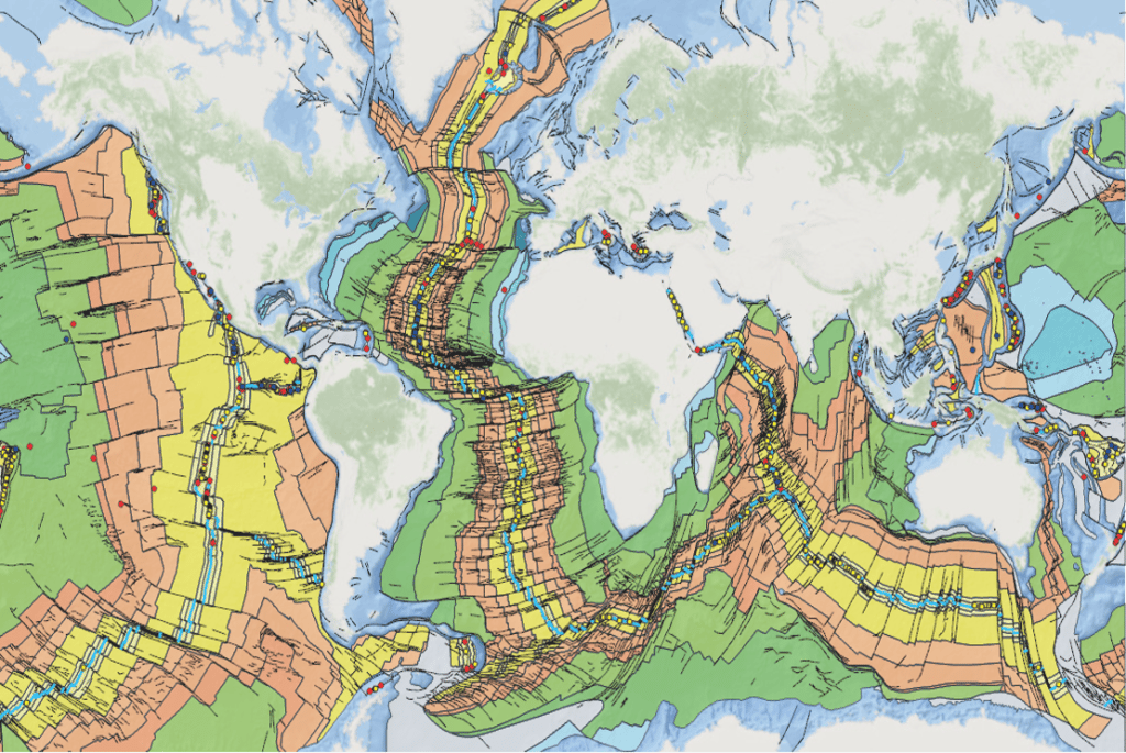
Geoscientific Mapping of the Ocean Realm: GeoMORe - Marine data (October 2022 version)
PLEASE CONTRIBUTE TO OUR SITE!
The GeoMORe project aims to support and promote the use of marine data for science and society, and to foster interdisciplinary work and projects in marine science.
Data and information on the ocean floor are scattered, often inaccessible, rarely compatible and often usable only by insiders. The UN Decade of Ocean Sciences has just begun (2021 - 2030) and the UN Sustainable Development Goal No.14 to conserve and sustainably use the oceans, seas and marine resources for sustainable development has been in force since 2015.
This website is being developed jointly by the CCMG Sub-Commission on the Ocean Floor and the IUGS. It aims to support these UN goals and to help scientists do their work in a practical way, by providing sources and links via a central GeoMORe hub.

In a first step, we compile and provide links to available offshore data from geological, geophysical, geochemical and geobiological investigations/mapping campaigns (raw and interpreted).
Secondly, you will find links to existing classifications, nomenclatures and standards (ocean features, sample acquisitions, analyses, etc.) needed to describe the mapped ocean floor features. More information here.
In a third step, links to other information systems/hubs such as OBIS (Ocean Biological Information System, IOC), EPOS and the work of CGI and DDE will be provided.
Finally, we invite you to help us make marine geoscience data accessible, and to host your data source references for regional, national or international marine data.

| Country/Region | Theme | Website |
| Denmark | Severity data | www.space.dtu.dk |
| USA | Gravity data | topex.ucsd.edu/pub/global_grav_1min |
| World | Surficial seafloor sediments Seafloor NOAA | https://www.ncei.noaa.gov/ |
| World | Hydrothermal winds | https://vents-data.interridge.org/ |
| World | Seamounts | bluehabitats.org |
| World | Seamounts | EarthRef.org |
| World | Marine physiographic features | bluehabitats.org |
| World | Global models of oceanic lithospheric age | earthdynamics.org |
| World | Global models of oceanic lithospheric age | gplates.org |
| World | Large Igneous Provinces and microcontinents | earthdynamics.org |
| World | Bathymetry data from satellite and ship-tracks | https://www.gebco.net/data_and_products/gridded_bathymetry_data/ |
| World | Magnetic anomaly data | https://www.ncei.noaa.gov/access/metadata/landing-page/bin/iso?id=gov.noaa.ngdc.mgg.geophysical_models:EMAG2_V3 |
| World | Global seismicity | http://www.isc.ac.uk/iscgem/overview.php |
| World | ODP, IODP core descriptions and sample data | https://www.iodp.org/resources/access-data-and-samples |
| World | Heatflow data | https://agupubs.onlinelibrary.wiley.com/doi/10.1029/2019GC008389 |
Country/Region | Interpreted data and maps: Theme | url |
Germany | German Oceanic Data Center of BSH | https://seadata.bsh.de/csr/retrieve/dod_index.htm |
Germany | Geology (on-and off shore, scale 250 k) | https://geoviewer.bgr.de/mapapps4/resources/apps/geoviewer/index.html?lang=de |
Europe | Seabed sediments: EMODnet geology | https://www.emodnet-geology.eu/ https://www.emodnet-geology.eu/map-viewer/ |
Europe | Seafloor geology EMODnet Geology: Quaternary, pre-Quaternary and geomorphology | https://www.emodnet-geology.eu/ https://www.emodnet-geology.eu/map-viewer/ |
Europe | Seafloor geology, EMODnet, Quaternary, pre-Quaternary Geomorphology | https://geoviewer.bgr.de/mapapps4/resources/apps/geoviewer/index.html?lang=de
|
Europe | Coastal Behaviour: EMODnet Geology | https://www.emodnet-geology.eu/ https://www.emodnet-geology.eu/map-viewer/ |
Europe | Events and probabilities: EMODnet Geology | https://www.emodnet-geology.eu/ https://www.emodnet-geology.eu/map-viewer/ |
Europe | Marine Minerals: EMODnet geology | https://www.emodnet-geology.eu/ https://www.emodnet-geology.eu/map-viewer |
Europe | Submerged Landscapes: EMODnet geology | https://www.emodnet-geology.eu/ https://www.emodnet-geology.eu/map-viewer/ |
Europe | Bathymetry: EMODnet Bathymetry | |
Europe | Pre-Quaternary Geology (on-and off-shore) BGR/CGMW: IGME 5000. European on-and offshore geology, scale 1 : 5 Million | https://geoviewer.bgr.de/mapapps4/resources/apps/geoviewer/index.html?lang=de
|
World | Global Multi-resolution topography Data Synthesis: |
Country/Region | Comprehensive data: Themes | URL |
World | Open Access Data Center | |
World | Earthbyte, Australia: global age grid, GML Magnetic anomaly identifications, Global and regional plate motion models and much more | Home |
Contacts
Initiators of the project:
Kristine Asch: BGRGermany
Manuel Pubellier, CCGM, ENS, CNRS, France
Hiroshi Kitazato, IUGS, Tokyo University of Marine Science and Technology (TUMSAT), Japan
Implementation : Camille François, CGMW
Umbrella organisation: Commission for the Geological Map of the World, France
