Definition: orogens develop in convergent settings involving two or more continental and/or oceanic plates. They are traditionally defined as zones of crustal deformation associated with mountain (relief) formation resulting from subduction zones, arc accretion, continent-continent collision or rift basin inversion.
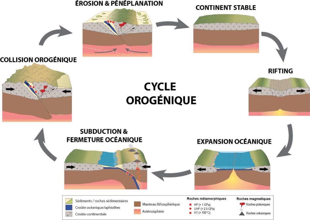
The che orogenic cycle, sometimes called the "Wilson cycle", was named by Dewey and Burke after their colleague Tuzo Wilson who, among others, foresaw in the late 1960s that the oceans were opening and closing, thus opening up new perspectives for research and explanation of the formation of mountain ranges over geological time.
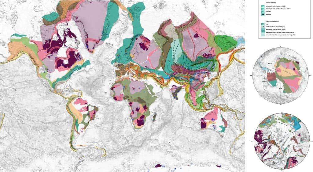
The objective of the project is to identify and describe the key elements of an orogen (faults, metamorphic and plutonic rocks, ophiolites...), and to represent them on a global (digital) map, in order to highlight the appearance and disappearance of mountain ranges through the geological history of the Earth (from the Archean to the present day). This map is intended to be educational, so that it can be explained simply to non-professional geologists, and to be used in classrooms, conferences or workshops.
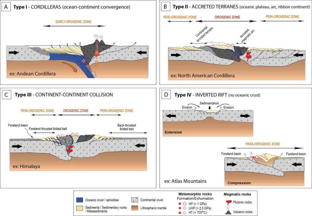
Different types of orogen
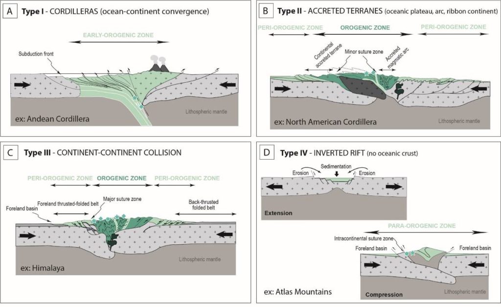
The major types of orogenic settings are subduction chains (Andean Cordilleras), accreted blocks (North American Cordilleras), collisional chains (Himalayas), and inverted rifts (Pyrenees, Atlas). Each context produces typical structures and markers that can be used to map orogens.
The four main types of convergent orogenic systems will be represented on our map:
Type I - Ocean-continent convergence accommodated by subduction,
Type II - Accretion/collision of crustal elements derived from subduction (island arc and/or back-arc basin), a micro-continent, an oceanic shelf or a ridge,
Type III - Continental collision, often after subduction ± accretion
Type IV - Shortening of an intracontinental sedimentary basin and continental crustal material.
As each of these types can only represent one stage in the development of an orogen in time and space, a transition between each stage can/should be considered.
How can orogens be represented on a map?
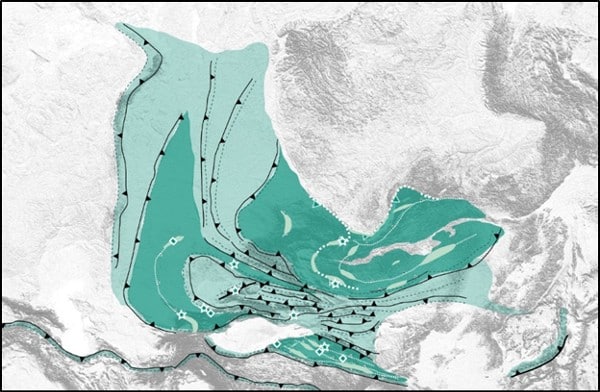
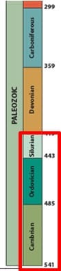
The main question of this project is how to represent these different types on the same map. An example of the Central Asian orogenic belt that ran from the Cambrian to the Silurian during the Caledonian events is the following:
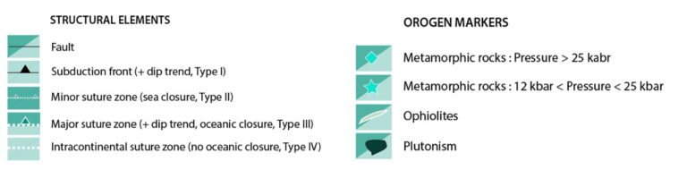
We consider that the orogenic (darker) zones, characterised by crustal deformation ± (U)HP, and/or (U)HT metamorphism, magmatism (aluminous granites) and/or ophiolites, represent the core of the orogenic system and correspond to what is often referred to as the "inner zone" and on the other hand, the early, peri- or para-orogenic zones in which the (mainly sedimentary) deformation comprises folding belts and low-grade metamorphism.
A digital map with several layers
Draft map as of 21/06/2022. World Map of Orogens, CCGM-CGMW.