As part of our commitment to the environment, we are changing our hosting provider to one that is more environmentally friendly. The site is currently being prepared for this transition.
Due to the summer break, the online shop will reopen on 15 August. Orders will be temporarily suspended until then.
Thank you for your patience and support.
We look forward to seeing you soon with an even more ethical and efficient site!
Due to the summer break, the online shop will reopen on 15 August. Orders will be temporarily suspended until then.
Thank you for your patience and support.
We look forward to seeing you soon with an even more ethical and efficient site!
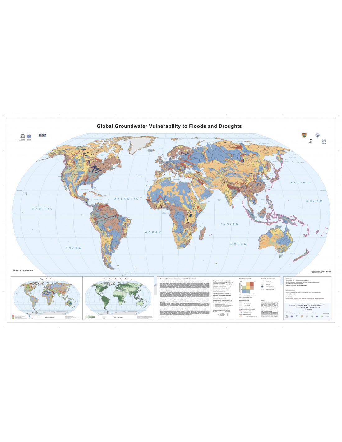
Global Flood and Drought Vulnerability Map
5,25 €
Global Flood and Drought Vulnerability Map
Chief Editors: Jaroslav Vrba and Andrea Richts
In collaboration with Wilhelm Struckmeier, Balbir Sukhija, Uta Philipp, Mangen Li, Wenbin Zhoy, Alice Aureli and the WHYMAP Steering Committee.
Under the auspices of UNESCO/IHP and the BGR (German Geological Survey)
Scale 1:40,000,000
Robinson screening
BGR Hannover / UNESCO, Paris 2015
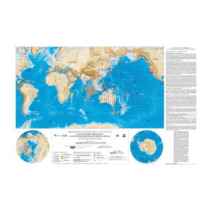
Global Flood and Drought Vulnerability Map
Description
Global Flood and Drought Vulnerability Map
The 1:40,000,000 World Map of Groundwater Vulnerability to Floods and Droughts is the result of a joint effort by several international bodies: the International Hydrological Programme (IHP) of the United Nations Educational, Scientific and Cultural Organization (UNESCO), the Global Groundwater Emergency Project (GWES), the International Association of Hydrogeologists (IAH) and the WHYMAP programme (see www.whymap.org).
The GWES project was implemented during the sixth (2002-2007) and seventh (2008-2013) phases of the UNESCO-IHP. Its aim is to study extreme natural disasters that could pose a threat to human health and life, and to identify potential safe, low-vulnerability groundwater resources that could replace the public water distribution service in the event that it is damaged or polluted as a result of emergency and/or post-emergency situations, making it possible to improve the efficiency of drinking water distribution operations to populations in distress.
The concept of groundwater vulnerability is based on the assumption that the physical environment can provide groundwater resources with a certain degree of protection against natural and human impacts, and that some aquifers are more vulnerable to external shocks than others. The purpose of the map is to support environmentally sound planning, regulation, management and decision-making in relation to land use and groundwater protection. It can also help to assess disaster risk and formulate risk reduction policies.
The World Map of Aquifer Vulnerability to Floods and Droughts combines data validated and/or published to date. These data highlight the relative vulnerability of the aquifers studied and therefore do not represent absolute values. The map shows the intrinsic vulnerability of a groundwater system and its fragility or resistance to natural disasters.
A CD with explanatory notes in English is supplied with the map.
Global Flood and Drought Vulnerability Map
Informations complémentaires
| Weight | 0,11 kg |
|---|---|
| Packaging | |
| Length | |
| Width | |
| Weight | |
| Scale |