As part of our commitment to the environment, we are changing our hosting provider to one that is more environmentally friendly. The site is currently being prepared for this transition.
Due to the summer break, the online shop will reopen on 15 August. Orders will be temporarily suspended until then.
Thank you for your patience and support.
We look forward to seeing you soon with an even more ethical and efficient site!
Due to the summer break, the online shop will reopen on 15 August. Orders will be temporarily suspended until then.
Thank you for your patience and support.
We look forward to seeing you soon with an even more ethical and efficient site!
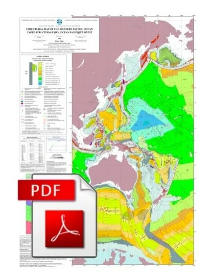
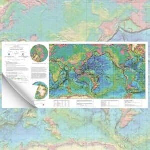
Structural map of the Western Pacific Ocean-PDF
53,00 €
Structural map of the Western Pacific Ocean-PDF
1st edition, 2016
Main map projection: Mercator
Original scale 1:20,000,000
Special edition 2017 reduced scale 1/28 000 000 Dimensions: 56 x 78 cm
Author : Peter Miles
Co-authors : Manuel Pubellier, CNRS-UMR 8538, Paris & Julien Collot, DIMENC-Nouvelle Calédonie, reviewed by Yves Lagabrielle, CNRS-UMR 6118, Rennes CCGM-CGMW .pdf version of the map, sent by download link.
Description
Structural map of the Western Pacific Ocean-PDF
Note: This map is subject to a licence agreement.
This map is also available in digital .pdf format in our catalogue.
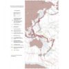
This map is based on physiographic, geological and geophysical data illustrating the structure of the region. Magnetic anomalies and the age of the seabed are shown in order to provide the reader with a precise and easy-to-read document. The colours and symbols used are identical to those used on previous 1:20 million scale maps of the oceans published by the CGMW, i.e. the structural maps of the Indian and Atlantic Oceans.
The representation of continental geology is limited to that of volcanism associated with the formation of oceanic margins. It is shown as island arc and ophiolite magmatism (relics of oceanic lithosphere carried onto the continental crust, obduction).
Structural map of the Western Pacific Ocean-PDF
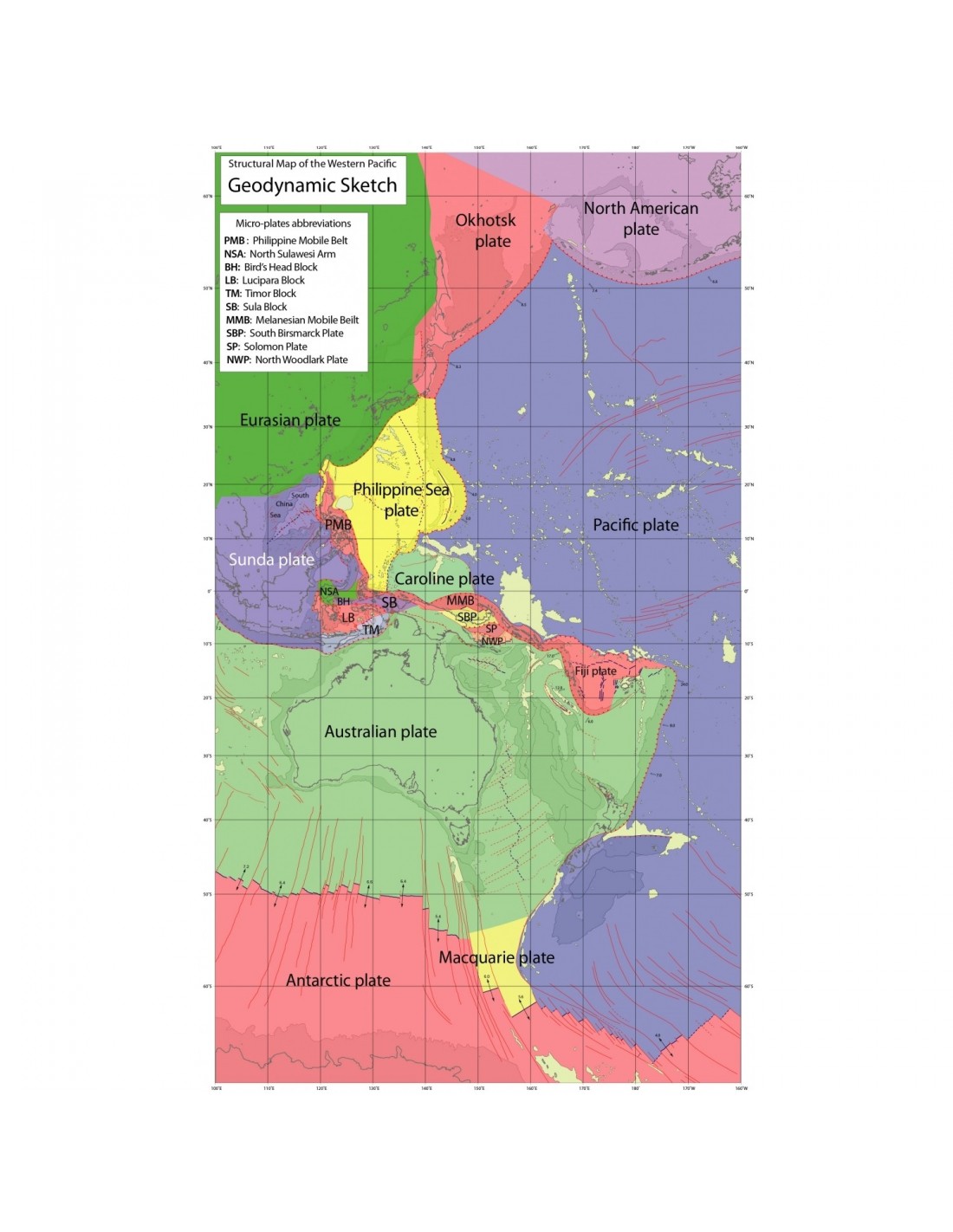
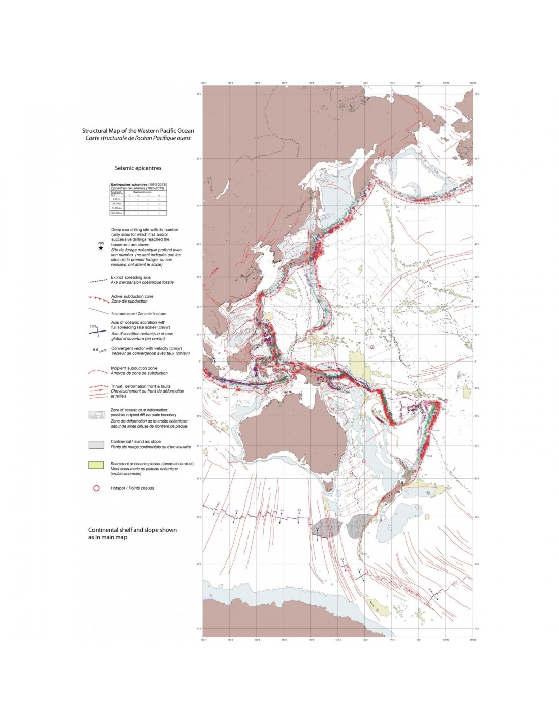
In order to maintain the readability of the A0 format printed version, the Structural Map of the Western Pacific Ocean includes the structural map, accompanied by a geodynamic diagram of the regional environment. A reduced image of the map showing the epicentres of earthquakes is provided in the explanatory notes (in English only, at download here). The pdf file of this map at the original scale of 1:20 million is available (click here). here to download).
Structural map of the Western Pacific Ocean-PDF
The main elements represented in the oceanic part are :
- Age of oceanic crust in Series/Epochs
- Magnetic anomaly measurement points at observation or interpretation sites and published magnetic lineaments
- Active and fossil oceanic accretion axes
- Transform faults and fracture zones
- Subduction zones and associated Benioff planes, deduced from the distribution of earthquake depths
- Abnormal underwater features
- Offshore sloping volcanic reflectors
- Thinned continental crust
- Hot spots
- Deep ocean drilling sites -DSDP, IPOD, ODP and IODP- where basaltic bedrock or transitional crust has been reached
- Sediment thickness
- Crustal deformation zones
Citation: Miles P., Pubellier M., Collot J., Structural map of the western Pacific Ocean at 1:20 000 000 scale. CCGM-CGMW 2016