A new look for our website! 🌱
As part of our commitment to the environment, we are in the process of switching to a more environmentally-friendly hosting provider. The site is currently being prepared for this transition.
Orders are temporarily suspended while the migration is finalised.
Thank you for your patience and support.
We look forward to seeing you soon with an even more ethical and efficient site!
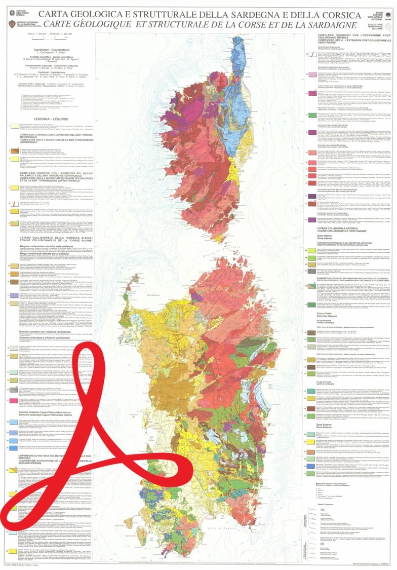
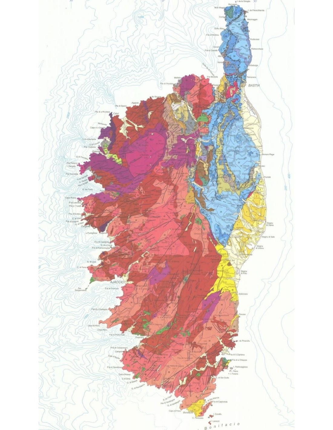
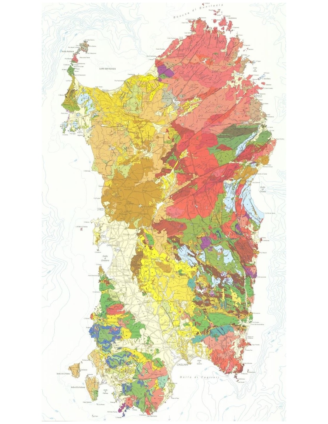
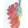
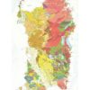
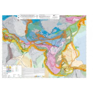
Geological map of Corsica and Sardinia-PDF
53,00 €
Geological map of Corsica and Sardinia-PDF
Scale: 1:500,000
Dimensions: 100 x 70 cm Coordinators: L. Carmignani, P. Rossi Editorial coordination: P. Conti, A. Eltrudis; A. Funedda, S. Pasci Bilingual Italian/French edition BRGM, Collectivité Territoriale de Corse
Dimensions: 100 x 70 cm Coordinators: L. Carmignani, P. Rossi Editorial coordination: P. Conti, A. Eltrudis; A. Funedda, S. Pasci Bilingual Italian/French edition BRGM, Collectivité Territoriale de Corse
Description
Geological map of Corsica and Sardinia-PDF
Note: This card is subject to a licence agreement.
This map is also available in digital .pdf format in our catalogue.
The originality of this Corso-Sardinian synthesis is to present the formations according to their chronology - as for the classic geological maps - but also according to the geodynamic context in which they were formed or are observed. Thus, the following have been distinguished:
1- for the Hercynian chain, the classic division into a) inner zone, b) nappes zone and c) outer zones and linking magmatism to the post-collisional extension of the chain;
2- the autochthonous cover of the South European continental margin;
3- the Balano-Ligurian and Ligurian-Piedmontese oceanic domain with continental influence;
4- the collisional chain of alpine Corsica, with in particular the eclogitic belt;
5- the complexes (in relation to the Apennines) linked to the opening of the Liguro-Provençal basin, the northern and then the southern Thyrrenian Sea.
Contributions: G. P. Cherchi, P. Conti, L. Disperati, A. Eltrudis, J. Ferrandini, A. Funeddan, J.-C. Lahondère, M.-D. Loÿe - Pilot, S. Pasci, E. Sarria, C. Spano