As part of our commitment to the environment, we are changing our hosting provider to one that is more environmentally friendly. The site is currently being prepared for this transition.
Due to the summer break, the online shop will reopen on 15 August. Orders will be temporarily suspended until then.
Thank you for your patience and support.
We look forward to seeing you soon with an even more ethical and efficient site!
Due to the summer break, the online shop will reopen on 15 August. Orders will be temporarily suspended until then.
Thank you for your patience and support.
We look forward to seeing you soon with an even more ethical and efficient site!
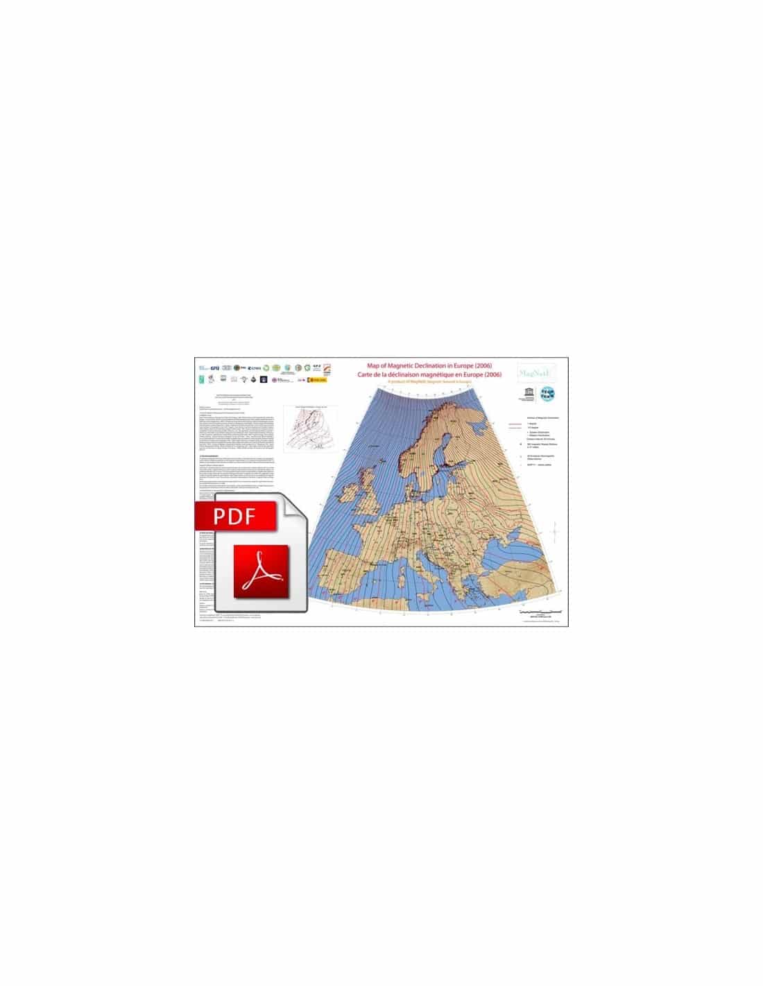
Map of magnetic declination in Europe-PDF(2006)
21,00 €
Map of the magnetic declination in Europe-PDF
Scale 1:20,000,000
Dimensions: 82 x 60 cm
CCMG 2012
Authors: Gerald Duma & Barbara Leichter (Central Institute for Meteorology and Geodynamics, Vienna - ZAMG) and the European research group MagNetE
Description
Map of the magnetic declination in Europe-PDF
Scanned version in high resolution .pdf format, sent by download link.
Note This card is subject to a licence agreement.
This map is also available in digital .pdf format in our catalogue.
The Map of the magnetic declination in Europe-PDF(2006) shows the deviation between magnetic and geographic north. It was produced from field measurements taken by 382 magnetic relay stations located in 21 states over the period 2005 to 2007. 42 geomagnetic observatories contributed to improving the density of spatial information by providing data corresponding to annual averages for the year 2006.
The map shows the magnetic declination resulting from the main field and the large-scale influences from magnetised structures within the Earth's crust. The map covers the area between meridians 13°W and 42°E and parallels between latitudes 35°N and 72°, spread over 100 km grids. In order to obtain an overall view of the magnetic declination field, the data were rendered on a regular grid from measurement points distributed irregularly over the European territory.
In the absence of field measurements at sea, e.g. to the north and west in the Atlantic Ocean and to the south in the Mediterranean Sea, and due to sparse measurements to the east, declination values from the International Geomagnetic Reference Field, IGRF 2011, have been added along these lines. The IGRF is a mathematical representation of the global magnetic field published by the International Association of Geomagnetism and Aeronomy (IAGA, http://www.ngdc.noaa.gov/IAGA/vmod/index.html).
The annual variation of the magnetic declination in Europe was obtained from the IGRF for the year 2006 and is shown in the small map. The mapping was done with the software Oasis montaj 7.2 (www.geosoft.com).
Map of the magnetic declination in Europe-PDF