Morpho-Bathymetric Map of the Eastern Mediterranean
10,50 €
Morpho-Bathymetric Map of the Eastern Mediterranean
1st edition 2015
Scale: 1:650,000
Projection: Mercator (N 38°)
Dimensions: 119 x 85 cm
Authors: Laëtitia Campistron-Brosolo and Jean Mascle
With the support of INSU/CNRS Mistrals project
Morpho-Bathymetric Map of the Eastern Mediterranean
Availability: In stock
Description
Morpho-Bathymetric Map of the Eastern Mediterranean
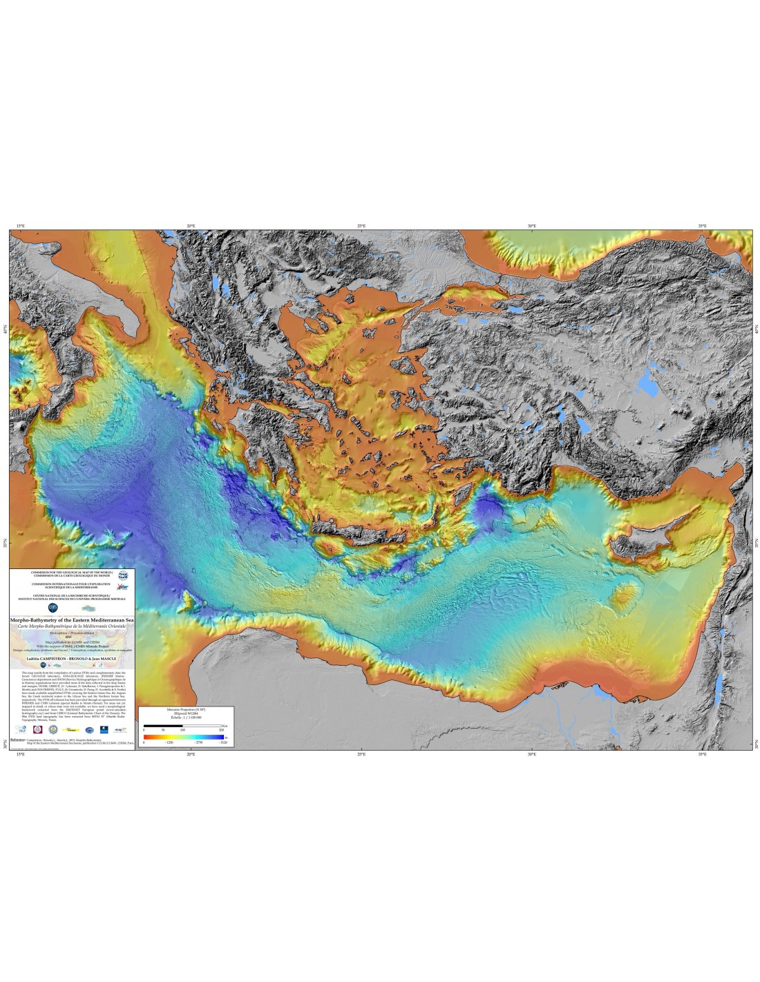
This morpho-bathymetric synthesis of the Eastern Mediterranean has been constructed from a 100m Digital Terrain Model (DTM) based on bathymetry data from various vessels of peri-Mediterranean institutes and agencies, acquired from often different multibeam systems. Nevertheless, it can be estimated that beyond water depths of 2000m, more than 90% of the basin floor could be mapped in detail by these systems.
The map was essentially constructed to illustrate, through these precise data, the variety of active geological processes (sedimentary, tectonic, fluid escape, magmatic) that shape and leave their spectacular footprints on the seabed of the eastern Mediterranean basin.
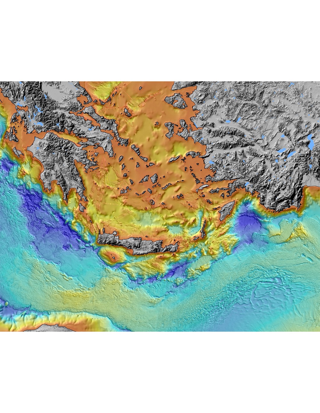
The graphical choices favour the detailed representation of the morphologies resulting from these processes in the four major geologically active domains of the basin from west to east: a) the Calabrian Prism (north of the Ionian Sea), b) the Mediterranean Wrinkle (central domain), c) the Nile Cone (north of the Egyptian coast) and d) Mount Eratosthenes (south of the island of Cyprus)
Outside the areas covered by this DTM, the map was completed with data from GEBCO (http://www.gebco.net/data_and_products/gebco_digital_atlas/) and the EMODNET project (http://www.emodnet-hydrography.eu/).
Several artefacts resulting from the use of these data (grid visibility in particular) are detectable over most of the continental margin areas not mapped by multibeam systems, as well as in the southern Adriatic Sea. In addition, it has not been possible to systematically correct all the non-linear Z-setting errors between the various 100m DTM data sets; these errors result either from the juxtaposition of data from different multibeam mapping systems (e.g. sounders operating at different frequencies), or from non-identical corrections to the speed of sound in water.
Morpho-Bathymetric Map of the Eastern Mediterranean
Additional information
| Weight | 0,134 kg |
|---|---|
| Packaging | Tube (e.g. rolled card), Envelope (e.g. folded card or booklet) |
| Length | |
| Width | |
| Weight | |
| Scale |