Mediterranean Pack
The cards included in this pack are in folded format.
Messinian Pack :
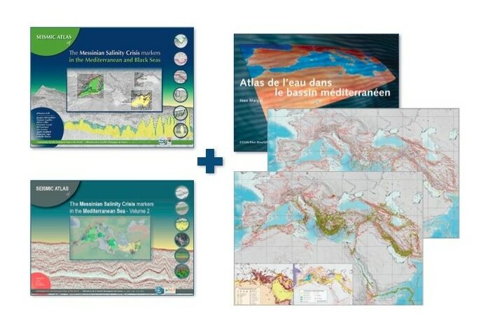
Seismic atlas of the Messinian Salinity crisis markers in the Mediterranean and Black Sea, vol. 1
72 pages + CD
In English only
Geological Society of France & CCGM 2011
Authors: J. Lofi, J. Déverchère, V. Gaullier, H. Gillet, C. Gorini, P. Guennoc, L. Loncke, A. Maillard, F. Sage and I. Thinon Seismic Atlas of the Messinian Salinity Crisis Markers in the Mediterranean Sea, vol. 2
72 pages + DVD
Published in December 2018
In English only
CCGM and Mémoires de la Société Géologie de France, n.s., t. 181.
Design and coordination : Johanna Lofi (University of Montpellier) Geodynamic map of the Mediterranean Set of 2 sheets :
Projection: Mercator
Scale: 1/13,000,000 at the equator (i.e. approximately 1/10,000,000 at the centre of the map)
Dimensions: 99 x 53 cm. Atlas of Water in the Mediterranean Basin
Atlas of Water in the Mediterranean Basin
48-page booklet
Published by UNESCO, the CCMG and Plan Bleu in 2004
UNESCO / CCGM 2004
Author: Jean Margat Mediterranean Pack
72 pages + CD
In English only
Geological Society of France & CCGM 2011
Authors: J. Lofi, J. Déverchère, V. Gaullier, H. Gillet, C. Gorini, P. Guennoc, L. Loncke, A. Maillard, F. Sage and I. Thinon Seismic Atlas of the Messinian Salinity Crisis Markers in the Mediterranean Sea, vol. 2
72 pages + DVD
Published in December 2018
In English only
CCGM and Mémoires de la Société Géologie de France, n.s., t. 181.
Design and coordination : Johanna Lofi (University of Montpellier) Geodynamic map of the Mediterranean Set of 2 sheets :
- Tectonics and kinematics
- Seismicity and Tectonics
Projection: Mercator
Scale: 1/13,000,000 at the equator (i.e. approximately 1/10,000,000 at the centre of the map)
Dimensions: 99 x 53 cm. Atlas of Water in the Mediterranean Basin
Atlas of Water in the Mediterranean Basin
48-page booklet
Published by UNESCO, the CCMG and Plan Bleu in 2004
UNESCO / CCGM 2004
Author: Jean Margat Mediterranean Pack