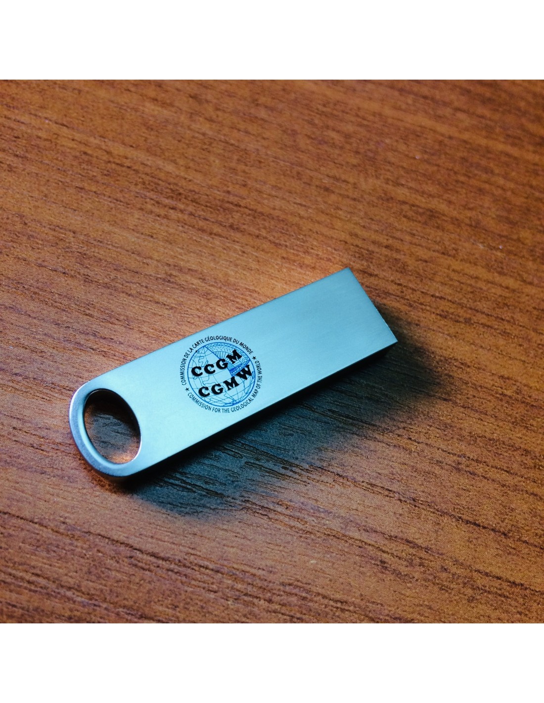


Clé USB CCGM – Licence cartes numérisées
2625,00 €
Clé USB CCGM – Licence cartes numérisées
Mini clé USB avec logo CCGM; comportant les licences de 49 cartes numérisées
dimensions : 4×1.2×0.4cm
49 cartes en format pdf sur les thèmes suivants:
• Géologie des continents et des océans
• Tectonique, sismotectonique et paléogéographie
• Hydrogéologie
• Géophysique
• Métallogénie
• Métamorphisme
• Environnement & Risques naturels Clé USB CCGM – Licence cartes numérisées
dimensions : 4×1.2×0.4cm
49 cartes en format pdf sur les thèmes suivants:
• Géologie des continents et des océans
• Tectonique, sismotectonique et paléogéographie
• Hydrogéologie
• Géophysique
• Métallogénie
• Métamorphisme
• Environnement & Risques naturels Clé USB CCGM – Licence cartes numérisées
Disponibilité : En stock
Description
Clé USB CCGM – Licence cartes numérisées
Conditions
Licence multi-poste exclusivement pour l’enseignement et la recherche d’une durée de 4 ans, renouvelable
Une licence globale pour l’ensemble de 49 cartes
Forfaits
2,500 Euros
Obtention de la Licence et des données
Votre demande de licence est formalisée par la signature d’un contrat de licence.
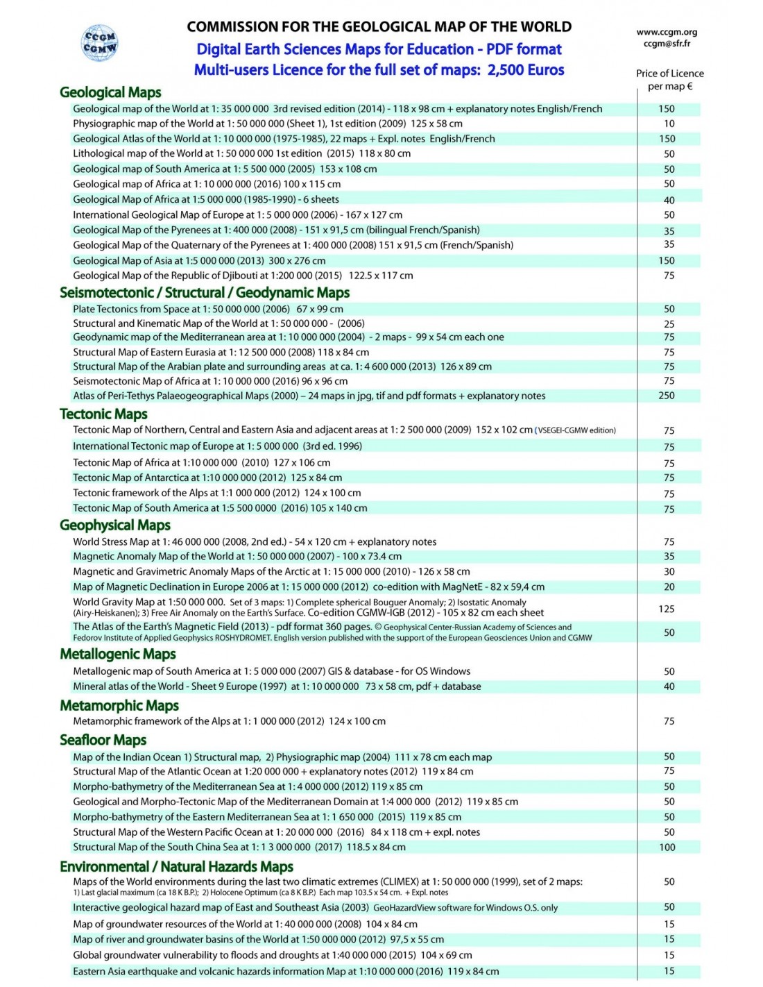
Cartes géologiques
- Geological map of the World, 3rd revised edition 2014
- Geological Map of the World. Sheet 1: Physiography, volcanoes, astroblemes, 2010
- Geological Atlas of the World, 1st edition
- Geological map of South America, 2nd edition, 1:5 000 000, 2001
- Geological map of Africa at 1: 10 000 000, 1st edition, 2016
- Geological Map of Africa at 1:5 000 000, 3rd edition, 1985-1990
- International Geological Map of Europe and Adjacent Areas at 1:5 000 000 scale, 1st edition, 2005
- Geological Map of the Pyrenees at 1: 400 000 scale, 1st edition, 2008
- Geological Map of the Quaternary of the Pyrenees at 1:400 000 scale, 1st edition, 2008
- Geological Map of Asia at 1:5 000 000, 1set edition, 2013
- Geological Map of the Republic of Djibouti, at 1:200 000, 1st edition, 2015
- Lithological map of the World, 1set edition, 1: 35 000 000, 2015
Clé USB CCGM – Licence cartes numérisées
Cartes sismotectoniques / Structurales / Géodynamiques / Paléogéographiques
- Plate Tectonics from Space at 1:50 000 000 scale at Equator, 1st edition, 2006
- Structural and Kinematic Map of the World at 1: 50 000 000 scale, 1st edition, 2006
- Geodynamic map of the Mediterranean, 2 sheets: 1: Tectonics and Kinematics; 2: Seismicity and Tectonics, at 1: 13 000 000 Equatorial scale, 2004
- Structural Map of Eastern Eurasia. Evolution of Crustal Blocks and Orogenic Belts through time at 1:12 500 000 scale, 2008
- Structural Map of the Arabian plate and surrounding areas at 1:4 600 000 scale, 2013
- Seismotectonic Map of Africa at 1: 10 000 000 scale, 2016
- Atlas of Peri-Tethys Palaeogeographical Maps at 1:10 000 000 scale at palaeoequator, 2000. Explanatory notes in English. 24 maps corresponding each of the following slices: Moscovian, Artinskian, Wordian, Olenekian, Early Ladinian, Late Norian, Late Sinemurian, Middle Toarcian, Middle Callovian, Early Kimmeridgian, Early Tithonian, Hauterivian, Early Aptian, Late Cenomanian, Campanian, Late Maastrichtian, Middle Ypresian, Late Lutetian, Late Rupelian, Early Burdigalian, Early Langhian, Late Tortonian, Piacenzian and Late Glacial Maximum
Cartes tectoniques
- Tectonic Map of Northern-Central-Eastern Asia and adjacent areas at 1: 2 500 000, 2009
- International Tectonic map of Europe at 1: 5 000 000, 3rd edition, 1996
- Tectonic Map of Africa at 1:10 000 000 scale, 2dedition, 2010
- Tectonic Map of Antarctica at 1:10 000 000; 1st edition, 2012
- Tectonic framework of the Alps at 1:1 000 000, 2012
- Tectonic Map of South America at 1:5 000 000, 2nd edition, 2016
Cartes géophysiques
- World Stress Map at 1:46 000 000, 2nd edition, 2009
- Magnetic Anomaly Map of the World at 1:50 000 000, 1st edition, 2007
- Magnetic and Gravimetric Anomaly Maps of the Arctic at 1:5 000 000, 1st edtion, 2010
- Map of Magnetic Declination in Europe 2006, 1st edition, 2012
- World Gravity Map at 1:50 000 000, 1st edition, 2012. Set of 3 maps: 1) Complete spherical Bouguer Anomaly; 2) Isostatic Anomaly; 3) Free Air Anomaly
- The Atlas of the Earth’s Magnetic Field, 1st English version from the original in Russian, 2013, 360 pages
Cartes métallogéniques
- Metallogenic map of South America at scales of visualization between 1:2 500 000 and 1:50 000 000, 1stdigital version, 2005. Explanatory notes in Spanish, Portuguese and English. Tutorials.
- International Metallogenic map of Africa at 1:5 000 000 scale, 2nd edition, 2002
- Mineral atlas of the World – Sheet 9 Europe at 1:10 000 000 scale, 1997. Digital version 2003
- Largest Mineral Deposits of the World, 1st edition in digital format, 2006.
Cartes métamorphiques
- Metamorphic framework of the Alps at 1:1 000 000 scale, 2012
Clé USB CCGM – Licence cartes numérisées
Cartes des fonds océaniques
- Map of the Indian Ocean 1) Structural map, 2) Physiographic map at 1:20 000 000 scale, 2004
- Structural Map of the Atlantic Ocean at 1:20 000 000, 1st edition, 2012
- Morpho-bathymetry of the Mediterranean Sea at 1:4 000 000 scale, 1st edition, 2012
- Geological and Morpho-Tectonic Map of the Mediterranean Domain at 1:4 000 000, 1st edition, 2012
- Morpho-bathymetry of the Eastern Mediterranean Sea at 1:1 650 000, 1st edition, 2015
- Structural Map of the Western Pacific Ocean at 1:20 000 000, 1st edition, 2016
- Structural Map of the South China Sea at 1:3 000 000, 2017
Clé USB CCGM – Licence cartes numérisées
Cartes environnementales / Risques naturels
- Maps of the World environments during the last two climatic extremes (CLIMEX) at 1:25 000 000, 1999. Map 1: Last Glacial Maximumsd (18 000 + 2 000 years B.P.). Average global temperature: 4.5°C lower than nowadays. Map 2: The Holocene Optiumum (8 000 + 1 000 years B.P.). Average global temperature: 2°C higher than nowadays. Explanatory notes in English and French.
- Interactive geological hazard map of East and Southeast Asia (2003) GeoHazardView software for Windows O.S. only
- Map of groundwater resources of the World at 1:25 000 000, 2nd edition, 2008
- Map of river and groundwater basins of the World at 1:50 000 000 scale, 1st edition, 2012
- Global groundwater vulnerability to floods and droughts at 1:50 000 000, 1st edition, 2015
- Eastern Asia earthquake and volcanic hazards information Map at 10 000 000 scale, 1st edition, 2016
Clé USB CCGM – Licence cartes numérisées
Informations complémentaires
| Poids | 0,01 kg |
|---|


