
Structural Map of the Arabian Plate and Surrounding Regions-PDF
79,00 €
Structural Map of the Arabian Plate and Surrounding Regions-PDF
Scale ca. 1:4 600 000
Released in November 2013
Dimensions: 126 cm x 89 cm
CCMG © 2013
Authors: Dominique Frizon de Lamotte & Pascale Leturmy
Availability: In stock
Description
Structural Map of the Arabian Plate and Surrounding Regions-PDF
Scanned version in high resolution .pdf format, sent by download link.
Note This card is subject to a licence agreement.
This map is also available in digital .pdf format in our catalogue.
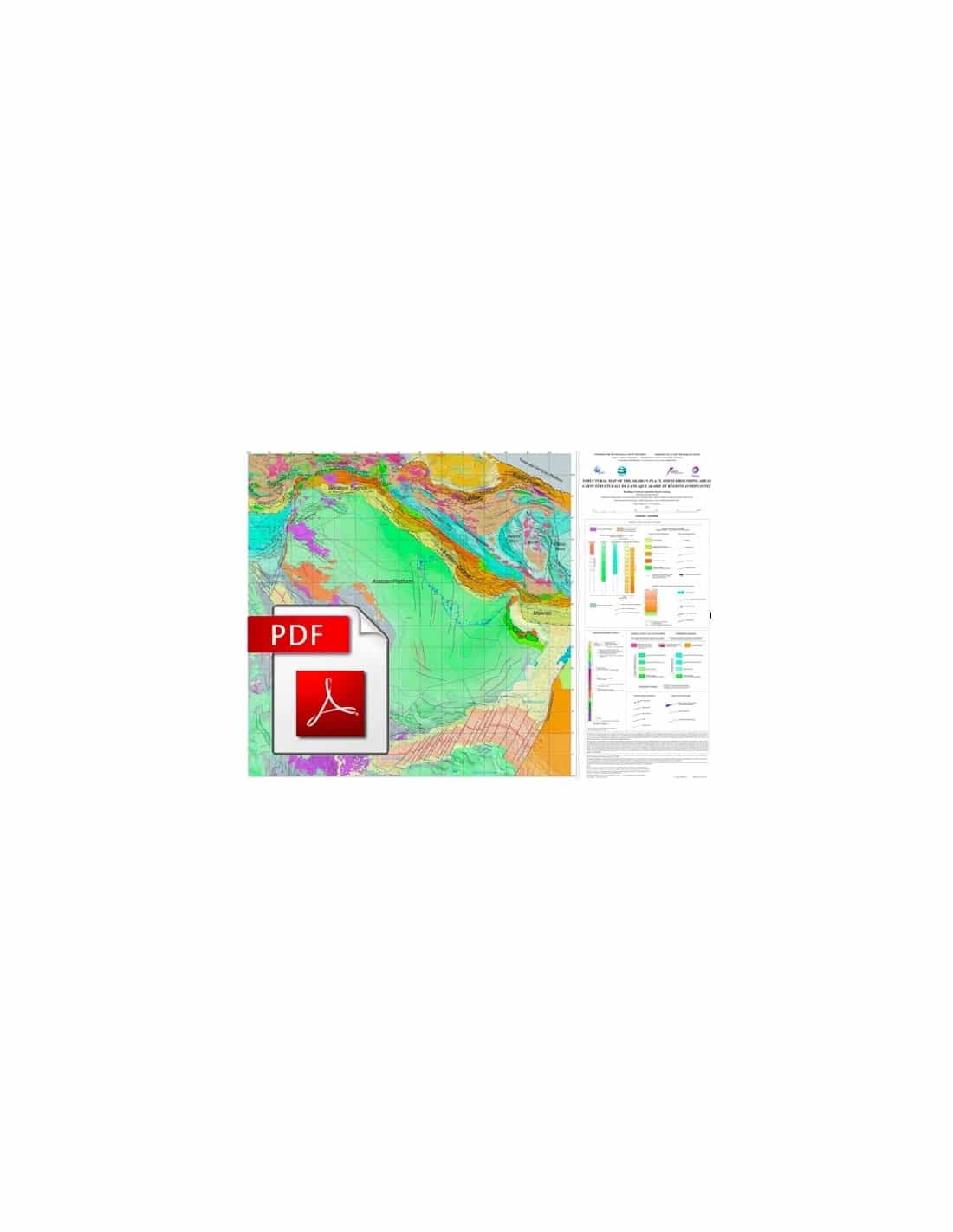
The Structural map of the Arabian Plate and surrounding areas was supported by the CGMW with the aim of establishing links between the Tectonic Map of Africa (published in 2010) and the International Tectonic Map of Asia (in progress), as well as because of the importance of the Arabian Plate in understanding the geodynamic processes that led to the collision between the African and Eurasian blocks.
The completion of this Structural map of the Arabian Plate and surrounding areas was carried out within the framework of research agreements between TOTAL, the University of Cergy-Pontoise and the CCGM. It is the result of a synthesis of a large number of international contributions and both published and unpublished data.
Structural Map of the Arabian Plate and Surrounding Regions-PDF
The map focuses on Phanerozoic evolution. Pan-African basement outcrops in the Arabian and Nubian shields are therefore not differentiated. On the basement, the thickness of weakly deformed domains (intracontinental basins, continental margins) have been represented by isopaques. Where possible (Arabian Platform), two series of isopaques are shown above and below the most important Palaeozoic unconformities beneath the Upper Carboniferous formations.
In the orogenic systems that link the Arabian platform to the north (Zagros, Makran and Oman ranges), the age of the main deformations is represented by colours. In the Zagros region, this representation shows the propagation of deformation from the suture to the fore-chain, as well as the current deformation front. A series of continental blocks are shown between the Zagros suture and the undifferentiated outcrops of the Eurasian domain in the NE corner of the map.
Two categories are distinguished, the Cimmerian blocks to the east and the Taurus-Armenian blocks to the west. Major sutures along the main plate boundaries and minor sutures in the Cimmerian and Taurus-Armenian domains are also clearly indicated.


