As part of our commitment to the environment, we are in the process of switching to a more environmentally-friendly hosting provider. The site is currently being prepared for this transition.
Orders are temporarily suspended while the migration is finalised.
Thank you for your patience and support.
We look forward to seeing you soon with an even more ethical and efficient site!
StratTime - Intelligent stratigraphic converter
0,00 €
StratTime
Free application running in Excel
To download version 6.3, click here (June 2024).
Please consult the following 2 files:
Description
StratTime: Intelligent Stratigraphic Converter
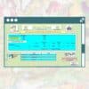
Anyone who hasn't spent time finding the correlation between a local stage or an obsolete stage and a stage on the Geological Time Scale doesn't need to StratTime. This tool has been specially designed to enable stratigraphic terms to be correlated quickly and easily.
The StratTime was originally developed for the Péri-Téthys, MEBE and DARIUS scientific programmes. The ultimate aim of these programmes was to establish a synthesis of the tectonic and stratigraphic evolution of the major sedimentary basins of vast geographical domains. These areas extend from the Atlantic Ocean to the Pamir Massif, on either side of the Alpine belt formed by the ancient Tethys Ocean.
New data obtained from the numerous field studies carried out as part of these programmes have enriched the already abundant literature available. The compilation of published articles has enabled the identification of more than 1,200 stratigraphic sub-divisions. By way of comparison, the International Stratigraphic Charter published for the 34th International Geological Congress in Brisbane, recognises only 177 stratigraphic subdivisions.
The floors managed by StratTime are not limited to the fields studied by the above-mentioned scientific programmes; all the sub-divisions used in the various countries of the world have been coded in StratTime.
A number of questions are raised when synthesising stratigraphic data, the most common being ".which validated floor the sub-division quoted in the article I'm reading corresponds to ?" La Stage Name sheet gives you the answer. Another question arises when you look at a map or a log with stratigraphic notations: "what time period these indices correspond to ?" La Stage Notation sheet will tell you.
If you have a result in numerical age, for example for a volcanic rock, the question that arises is: "What is the numerical age?which floor this age corresponds to ?" La Numerical Age sheet has the answer too. Finally, if you're working on kinematics or if you have magneto-stratigraphic data, the Which Chron sheet will give you the equivalents.
StratTime offers three other conversion tables:
- The GSSP sheet is a copy of the table of the International Stratigraphic Commission (ICS) the original of which can be downloaded from the ICS website. The one we are proposing has been modified to include links between the latitude and longitude data for each GSSP and the Google Map application.
- The ICS charts sheet brings together the charters published since 2004 by the International Commission on Stratigraphy (ICS), a commission of theInternational Union of Geological Sciences (IUGS)all available on the ICS website.
- The Color Code sheet gives the CMYK and RGB colour code values for each floor. These codes have been defined by the CCGM and accepted by the ICS as a standard for all ICS charters.
StratTime is a product of DARIUS programme and was developed at theParis Institute of Earth Sciences (ISTeP)
About the author of StratTime
The Dr. Bruno Vrielynck is a CNRS researcher and geologist specialising in palaeogeography. He works at ISTeP, UMR at the Université Pierre et Marie Curie, Paris.
Contact:
Bruno VRIELYNCK
Institute of Earth Sciences Paris
(UMR 7193 UPMC-CNRS)
Evolution and Modelling of Sedimentary Basins Team
UPMC Paris Universities
Case courrier 129
4 place Jussieu
75252 Paris cedex 05
email : bruno.vrielynck@orange.fr


