A new look for our website! 🌱
As part of our commitment to the environment, we are in the process of switching to a more environmentally-friendly hosting provider. The site is currently being prepared for this transition.
Orders are temporarily suspended while the migration is finalised.
Thank you for your patience and support.
We look forward to seeing you soon with an even more ethical and efficient site!
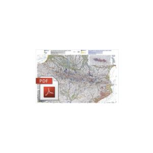
Geomorphological and Tectonic Map of the Mediterranean Area-PDF
79,00 €
Geomorphological and Tectonic Map of the Mediterranean Area-PDF
Scale 1:4,000,000
Total surface area: 119 x 85 cm
CCMG © 2012
Authors: Jean Mascle and Georges Mascle
.pdf version sent by download link.
Note This card is subject to a licence agreement, which can be downloaded under the "Download" tab on this page, and which must be signed and returned to ccgm@sfr.fr in order to receive the documents.
Description
Geomorphological and Tectonic Map of the Mediterranean Area-PDF
Note: This card is subject to a licence agreement.
This map is also available in digital .pdf format in our catalogue.
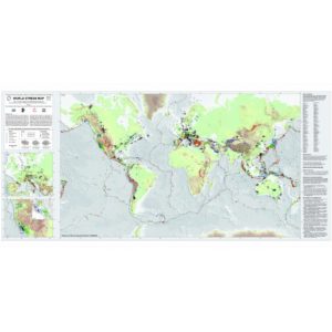
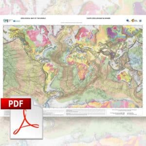
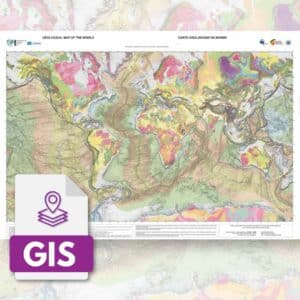
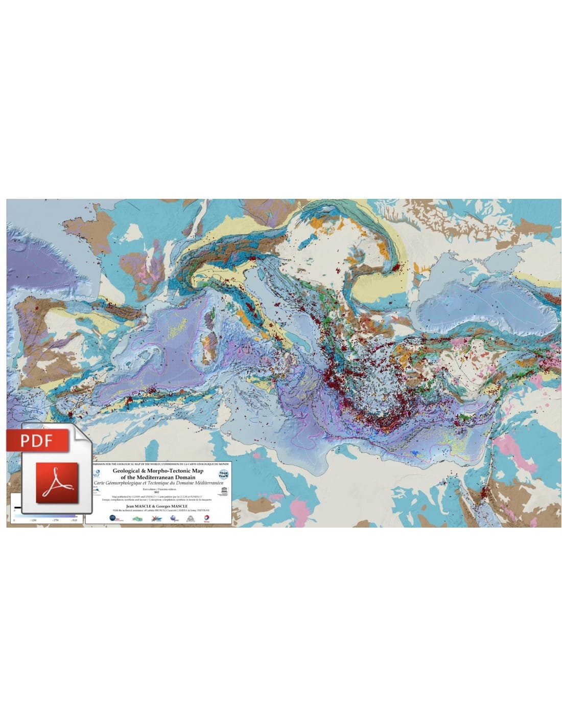
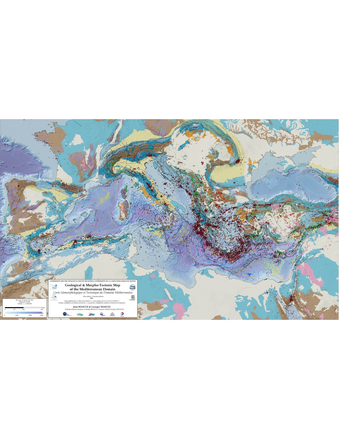
After the publication in April 2012 of a new morpho-bathymetric synthesis of the Mediterranean at the scale of 1:4,000,000, jointly produced by Geoazur, the DT-Insu (Mistrals programme) and Ifremer, a geological and morpho-tectonic synthesis of the entire Mediterranean domain (marine basins and surrounding geology) was also published in June 2012 by the CCGM.
This synthesis was carried out by J. Mascle (DR CNRS emeritus, Géoazur) for the marine domain, and G. Mascle (formerly Professor at the J. Fourrier University of Grenoble) for the peri-Mediterranean domain, with the help of the DT-Insu (Mistrals programme).
Built in an Arcgis environment, this compilation, the first ever published on the scale of the entire Mediterranean, results from the superposition of nearly thirty different layers representing as many thematic syntheses.
Geomorphological and Tectonic Map of the Mediterranean Area-PDF
On land, the structuring of the Mediterranean domain being closely linked to the evolution of the Alpine system, the terrains were grouped according to their involvement in the Alpine structures, while being aware of the importance of the temporal and spatial variability throughout the Alpine history.
At sea, the proposed synthesis takes into account various characteristics of the marine domains such as the nature and age of the deep basins, the distribution of the main "Messinian" evaporite basins, as well as that of the various structures (diapirs, saliferous tectonics) resulting from these deposits; the main current and/or recent tectonic deformations, as well as the distribution of muddy volcanism and other fluid outflows, have also been indicated on the scale of the entire Mediterranean domain. Finally, the location of earthquake epicentres (greater than magnitude 4) has been superimposed on the entire domain in order to highlight the limits of the major tectonically active complexes as well as the limits of the plates involved.
Geomorphological and Tectonic Map of the Mediterranean Area-PDF
The notes and references for this map can be downloaded by clicking here