A new look for our website! 🌱
As part of our commitment to the environment, we are in the process of switching to a more environmentally-friendly hosting provider. The site is currently being prepared for this transition.
Orders are temporarily suspended while the migration is finalised.
Thank you for your patience and support.
We look forward to seeing you soon with an even more ethical and efficient site!

World gravity map - PDF
132,00 €
World gravity map - PDF
Scale 1:50 000 000
Published in 2012
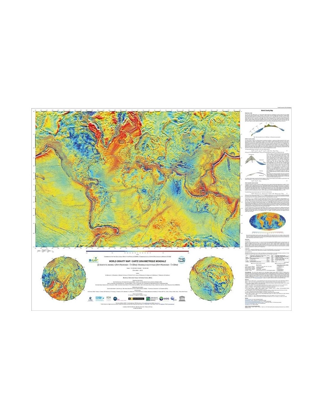
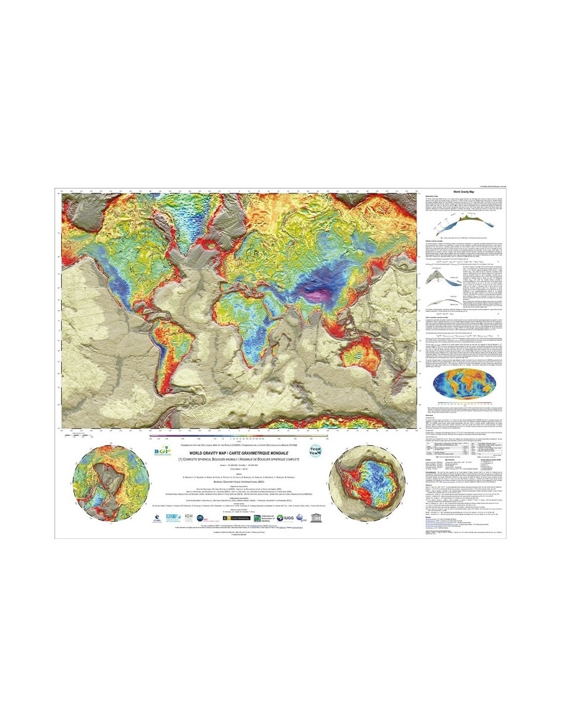
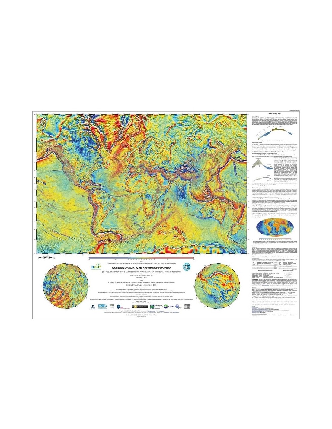
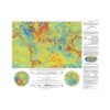
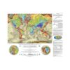
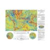
Set of 3 cards: Bouguer anomalies, isostatic (Airy-Heiskanen), free air on earth surface
Dimensions: 105 x 82 cm
CCGM, BGI, CNES, IRD © 2012
Authors: S. Bonvalot, G. Balmino, A. Briais, M. Kuhn, A. Peyrefitte, N. Vales, R. Biancale, G. Gabalda, G. Moreaux, F. Reinquin and M. Sarrailh
Description
World gravity map - PDF
Scanned version in high resolution .pdf format, sent by download link.
Note: This map is subject to a licence agreement.
This map is also available in digital .pdf format in our catalogue.
The World Gravity Map-PDF is a set of 3 global maps of anomalies in the Earth's gravity field, calculated by the International Gravity Bureau (IGB), a service of the International Association of Geodesy (IAG).
This set of digital maps, produced for the Commission of the Geological Map of the World (CGMW), UNESCO, the International Union of Geodesy and Geophysics (IUGG) and the International Union of Geological Sciences (IUGS), represents the world's first spherically symmetric gravity anomaly maps based on a realistic Earth model.
World gravity map - PDF
Calculated from available global gravity field models (EGM08, DTU10), the gravity anomalies presented here (Bouguer, Air-Free, Isostatic) include high-resolution topographic corrections, taking into account the effect of masses related to continents, oceans, inland lakes and seas and ice caps.
New theoretical developments have been carried out to enable high-resolution computation at the global scale (Balmino, G., Vales, N., Bonvalot, S. and Briais, A., 2011, Spherical harmonic modeling to ultra-high degree of Bouguer and isostatic anomalies, Journal of Geodesy, DOI 10.1007/s00190-011-0533-4).
Such anomaly maps, reflecting the density heterogeneities within the Earth (crust, mantle...), are used in many applications in earth physics, structural geology, geodesy (shape of the Earth, geoid), as well as for natural resources exploration (mining and oil exploration). Soon to be available in digital form, they are intended to be updated and disseminated for research and educational purposes.
This project, led by the Bureau Gravimétrique International (BGI), is the result of a collaboration between various research institutes from different countries (France, Germany, Australia, Denmark, USA). The WGM2012 grids (2'x2′ resolution) and the explanatory leaflet in English can be downloaded from the Bureau Gravimétrique International (BGi) website : http://bgi.omp.obs-mip.fr/data-products/Grids-and-models/wgm2012
World gravity map - PDF