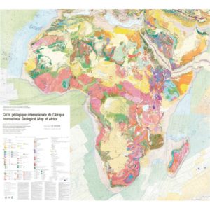
Geological Map of Africa-GIS
895,00 €
Geological Map of Africa-GIS
Mercator projection
Scale 1: 10 000 000
Geodatabase in GIS format
Copyright CCMG-BRGM 2016
Authors: D. Thiéblement (Editor, BRGM), J-P. Liégeois, M. Fernandez-Alonso, A. Ouabadi, B. Le Gall, R. Maury, M. Jalludin, M. Vidal, C. Ouattara Gbélé, R. Tchaméni, A. Michard, P. Nehlig and P. Rossi .
Geomatics and GIS construction: Frédéric Chêne
Availability: In stock
Description
Geological Map of Africa-GIS
Note: This GIS is subject to a licence agreement.
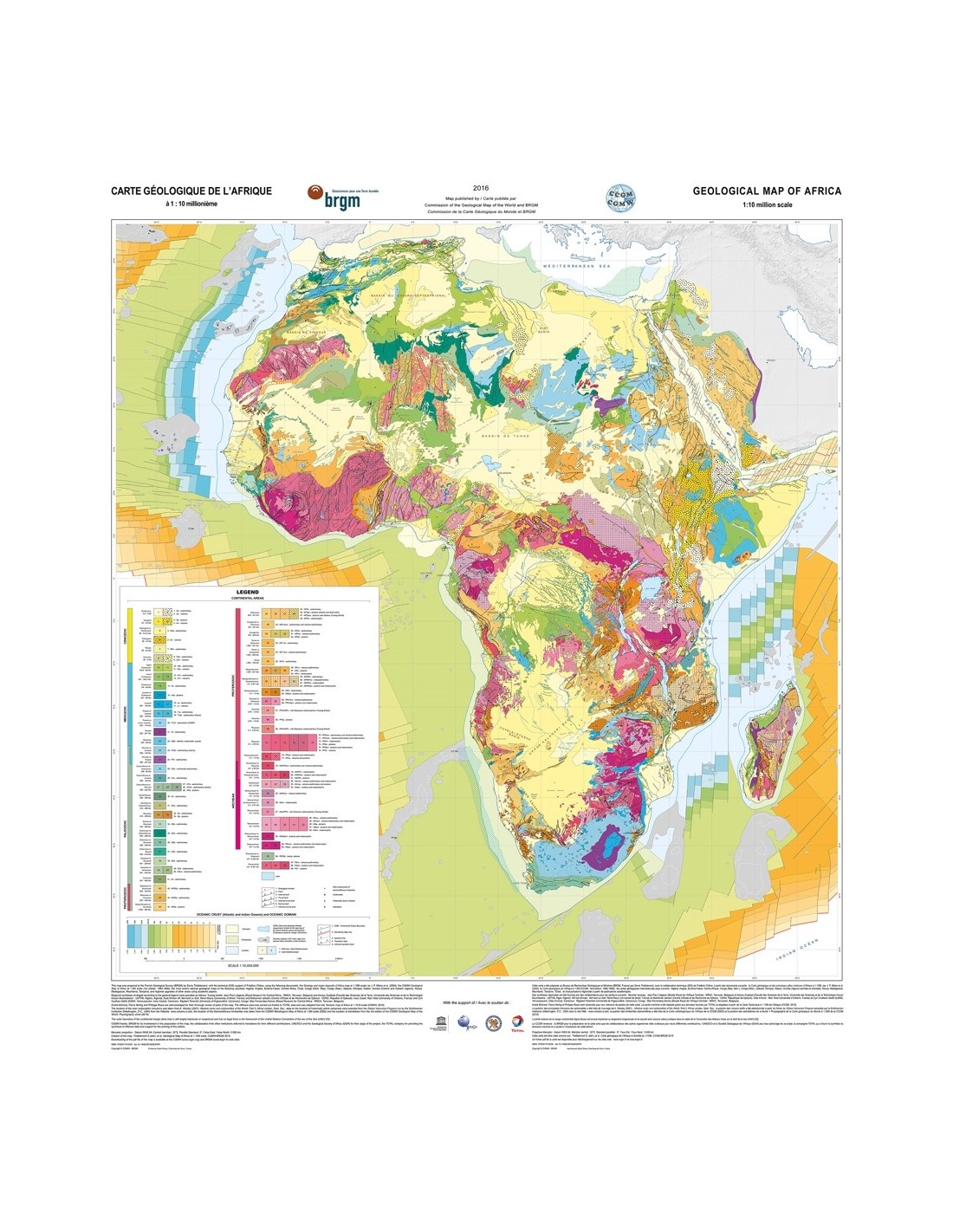
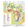
A new edition of the 10 million scale Geological Map of Africa was produced on the occasion of the 35e International Geological Congress (Cape Town, 29 August-2 September 2016) under the impetus of the Commission of the Geological Map of the World (CGMW), with the support of UNESCO and the Geological Society of Africa, and the technical and scientific coordination of BRGM.
This new map largely reproduces the geological data of the Geology and main deposits of Africa map published on the same scale on the occasion of the 20th Congress of African Geology (Orléans, 2-7 June 2004) while enriching it with works published since.
In line with recent developments in geological mapping, the new edition is mainly guided by the time parameter and uses, with very little modification, the colour code recommended by the CGMW. At first sight, it is therefore the organisation into large domains (basins, orogens) of different ages that stands out, the discrimination of rock types in each domain being obtained by the use of overloads.
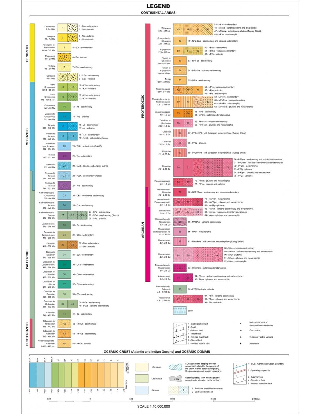
The geodatabase contains the following information layers:
- Geological formations in the Earth
- Linear structural elements in earth
- Geological formations at sea
- Boundary of the geological formations in the sea
- Structural linear elements in the sea
- Oceanic plateaus
- Oceanic plateau boundary
The high-resolution jpg file of the legend is available for download here
With the constraints inherent in producing a small-scale synthesis of a very large region, this new edition aims to make the overall geological organisation of Africa easily perceptible, leading to a continental-scale vision.
Geological Map of Africa-GIS
Additional information
| Digital format |
|---|