A new look for our website! 🌱
As part of our commitment to the environment, we are in the process of switching to a more environmentally-friendly hosting provider. The site is currently being prepared for this transition.
Orders are temporarily suspended while the migration is finalised.
Thank you for your patience and support.
We look forward to seeing you soon with an even more ethical and efficient site!
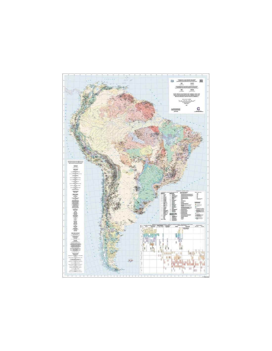
Metallogenic map of South America
32,00 €
Metallogenic map of South America
2nd edition - Scale 1:5,000,000
Published in 2005
4 sheets (folded) - Size of each sheet: 89 x 66 cm
Explanatory leaflet in Spanish/Portuguese/English
Publication of the Geological and Mining Survey of Argentina (SEGEMAR)
under the aegis of the CCMG and the Iberoamerican Association of Geological and Mining Services (ASGMI).
Description
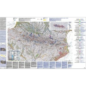
Metallogenic map of South America
This product comes in the form of folded cards and a booklet.
The second edition of the Metallogenic Map of South America was published in 2005 by the Geological and Mining Service of Argentina (SEGEMAR) under the aegis of the CCGM and the Ibero-American Association of Geological and Mining Services (ASGMI).
It covers an area of around 18 million km² and presents the main characteristics (identification, morphology, resources, mineralogy, genesis, legal status, etc.) of 1,500 metal deposits, placing them in their tectonostratigraphic context.
The mapping was based on the GIS of the Geological Map of South America (2001), whose geological formations were updated and grouped together to define the metallogenic and tectonostratigraphic units.
The classification of the metalliferous deposits has followed the rules established in the recent international metallogenic maps. This document presents the most updated view of metallogenic knowledge in South America and is therefore a scientific and economic guidance document of primary importance.
This publication is accompanied by an explanatory booklet of almost 150 pages in three languages: Spanish, Portuguese and English. The GIS generated by this compilation work is available on the SEGEMAR web page www.segemar.gov.ar. Its digital format and the availability of the map data online facilitate the updating of the information and access by users.
This map is the result of close cooperation between the South American countries and was coordinated by Dr. Eduardo O. Zappettini of SEGEMAR.
Metallogenic map of South America
Informations complémentaires
| Weight | 1,335 kg |
|---|---|
| Packaging | |
| Length | |
| Width | |
| Weight | |
| Scale |