As part of our commitment to the environment, we are in the process of switching to a more environmentally-friendly hosting provider. The site is currently being prepared for this transition.
Orders are temporarily suspended while the migration is finalised.
Thank you for your patience and support.
We look forward to seeing you soon with an even more ethical and efficient site!
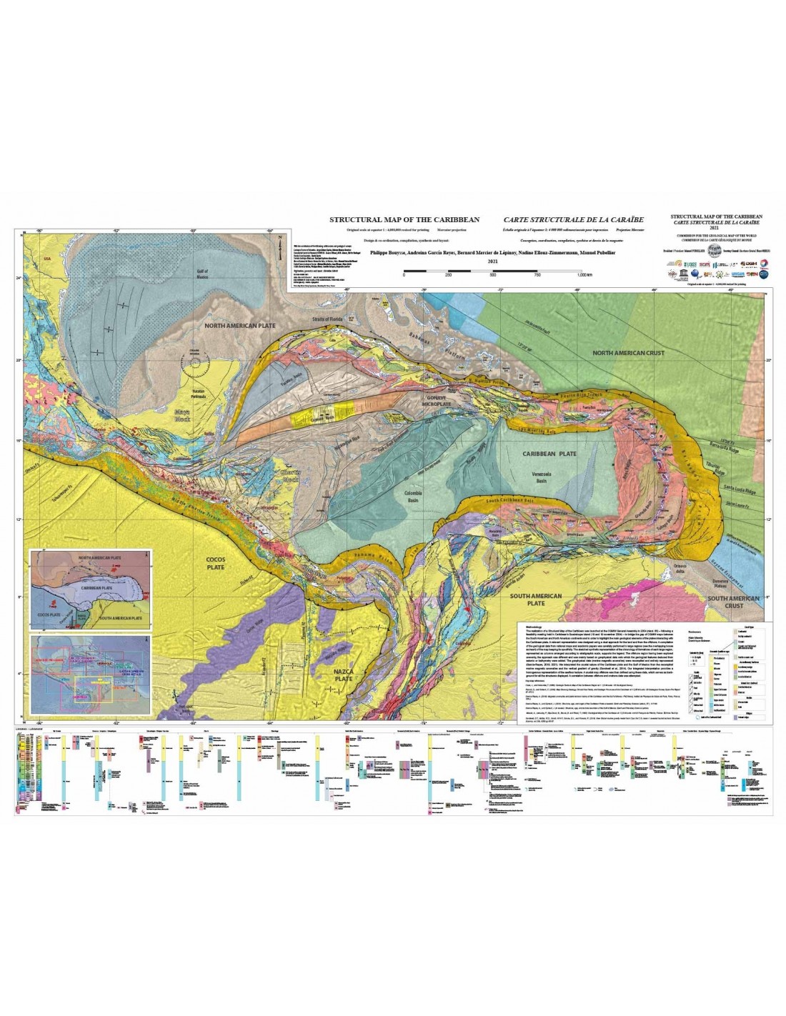
Structural map of the Caribbean
21,00 €
Scale: 1:4,000,000 resized for printing
Projection: Mercator Card size : 114 x 90 cm (1 sheet) Compiled by : Philippe Bouysse, Andreina García Reyes, Bernard Mercier de Lépinay, Nadine Ellouz-Zimmermann, Manuel Pubellier.
Digitisation, geomatics and layout: Christine Cabrit
CCGM-CGMW 2021ISBN: 978-2-917310-39-7 DOI:10.14682/2021STRUCTCRB
Description
Structural map of the Caribbean
The production of a Structural Map of the Caribbean was launched at the General Assembly of the CCMG in 2004 (resol. 65) - following a feasibility meeting held in the Caribbean, in Guadeloupe (18 and 19 November 2004) - to fill the gap in the CCMG maps between the South American and North American continents and to highlight the main geological features of the plates interacting with the Caribbean plate. A relevant representation was designed using a dual approach for onshore and offshore.
A compilation of geological data from national maps and academic articles has been carefully carried out in large regions (see overlapping boxes in insert) of the map, while retaining its specificity. The legend is supported by an outline of the chronology of the formations in each major region, represented in the form of columns arranged according to stratigraphic scale.
As the offshore area had been explored unevenly, the approach was different and based mainly on geophysical data, to which were added geological features deduced from seismic or bathymetry. The geophysical data (marine magnetic anomalies) were recompiled and fully reprocessed (García-Reyes, 2018; 2021). We interpreted the crustal nature of the Caribbean Plate and the Gulf of Mexico from the recompiled marine magnetic anomalies and the vertical gravity gradient (Sandwell et al., 2014). A correlation between offshore and onshore data was attempted.
With the collaboration of :
Geological Survey of Colombia: Jorge Gómez Tapias, Nohora Montes Ramírez
Universidad Central de Venezuela/FUNVISIS Franco Urbani, Ali R. Gómez, Walter Reátegui
Florida State University : David Farris
Servicio Geológico Mexicano : Enrique Espinosa Aramburu
Museo Nacional de Historia Natural de Cuba, La Habana, Cuba Manuel Iturralde Vinent
United States Geological Survey: Michael Machette, Jean Weaver, Peter Lyttle
CCMG : Clara Cardenas, Philippe Rossi, Camille François, Benjamin Sautter
Informations complémentaires
| Weight | 0,140 kg |
|---|---|
| Dimensions | 90 × 114 × 0,01 cm |
| Packaging | Tube (e.g. rolled card), Envelope (e.g. folded card or booklet) |
| Length | |
| Width | |
| Weight |


