As part of our commitment to the environment, we are in the process of switching to a more environmentally-friendly hosting provider. The site is currently being prepared for this transition.
Orders are temporarily suspended while the migration is finalised.
Thank you for your patience and support.
We look forward to seeing you soon with an even more ethical and efficient site!
Structural map of the South China Sea-PDF
105,00 €
Structural map of the South China Sea-PDF
1st edition, scale 1:3 000 000
Projection: Mercator Equidistant
Dimensions: 118.5 x 84 cm
Authors: M. Pubellier, D. Savva, M. Aurelio, F. Sapin
Collaborators: J.L Auxiètre, N. Chamot-Rooke, L.S. Chan, H. Darman, M. Delescluse, D.Franke, V. Le Gal, C.S. Liu, M. Madon, Y. Mansor, K. McIntosh, D. Menier, F. Meresse, V. P. Phung, B. Sautter, J-C. Sibuet, S. Steuer, K. Taguibao, V.T. Tran
© CCGM-CGMW 2017
Description
Structural map of the South China Sea-PDF
.pdf version sent by download link.
Note This card is subject to a licence agreement.
This map is also available in digital .pdf format in our catalogue.
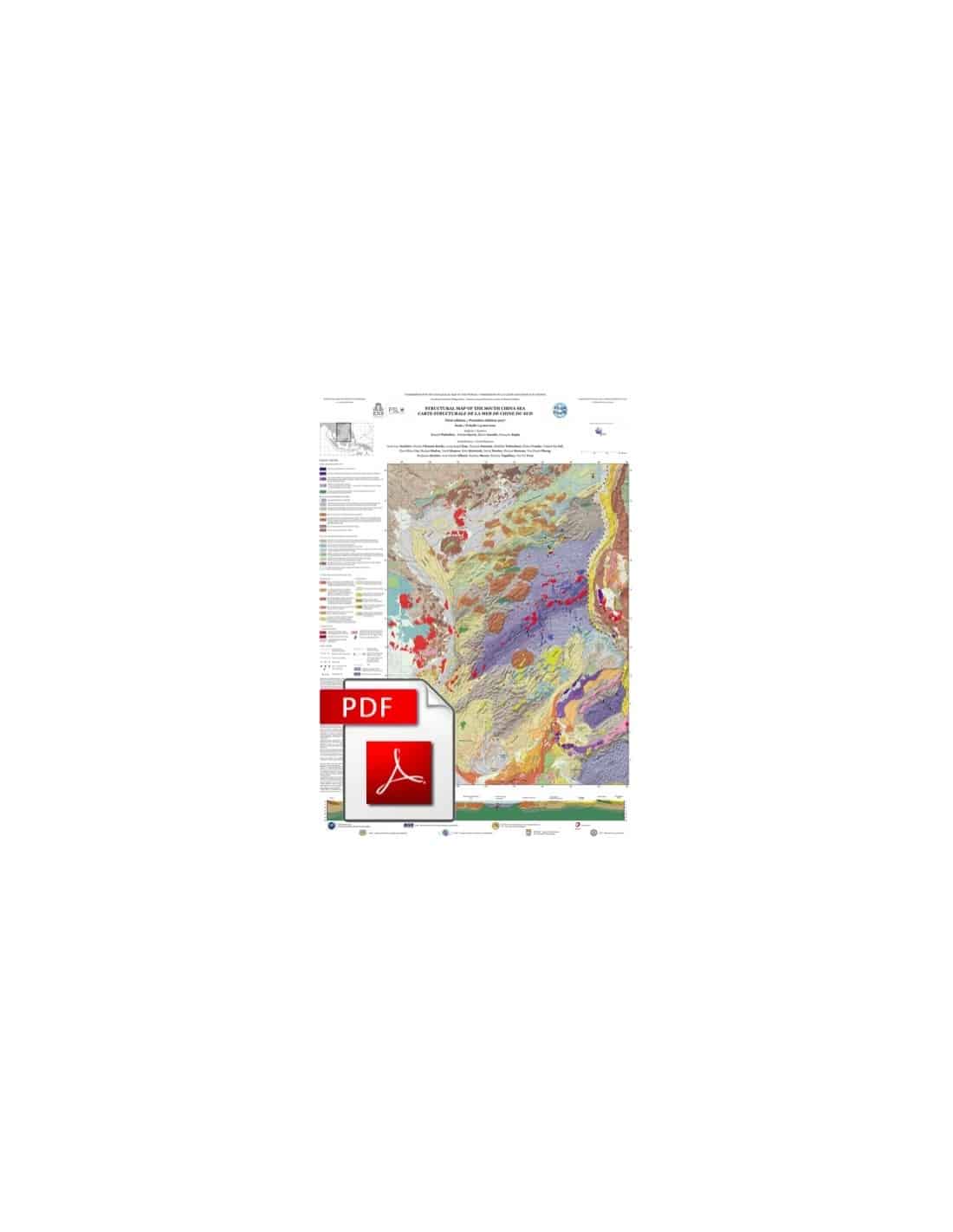
This structural map of the South China Sea synthesises a very large volume of data from academic and industrial research. Its objective is to present the main structures that have played a key role in the formation and evolution of the South China Sea.
The colours of the features represented in the map have been chosen to facilitate the correlation of the continental and oceanic parts of the structural units. Ante-Jurassic basement rocks have not been differentiated, but particular attention has been paid to Mesozoic granitoids, magmatic and metamorphic rocks, and Cenozoic volcanic edifices located offshore and on the seafloor.
The main crustal domains distinguished are: thick continental basement, stretched continental crust, assumed exhumed mantle zones (including under post-accretionary sediments), volcanic arc crust in the Philippines, and oceanic crust. Represented in the continental and oceanic domains are: prism, platform and basin sediments as well as the extent of Mesozoic marine environments.
The age of the crust in basins other than those in the South China Sea (Celebes Sea, Sulu Sea), has not been specified. Distended Cenozoic basins are highlighted and shown in transparency above the accretionary structures. Instead of showing peaks or patterns of magnetic anomalies that are still open to discussion, the map shows uncontrolled magnetic anomalies, thus emphasising the structural framework of the ocean floor.
The faults shown on the map are those associated with the extension of the crust during the early Cretaceous. Other faults, reverse or thrust faults, set up during the Middle Miocene and Pliocene, can be oblique or parallel to the accretion faults. The representation, in thin red lines, highlights the surface faults characterising the gravity tectonics affecting the powerful Miocene deltas of the South China Sea.
The "Structural Map of the South China Sea-PDF" is complemented by a section based on published data from the international literature. This section provides a very nice picture of a hyper-stretched margin affecting a batholith.
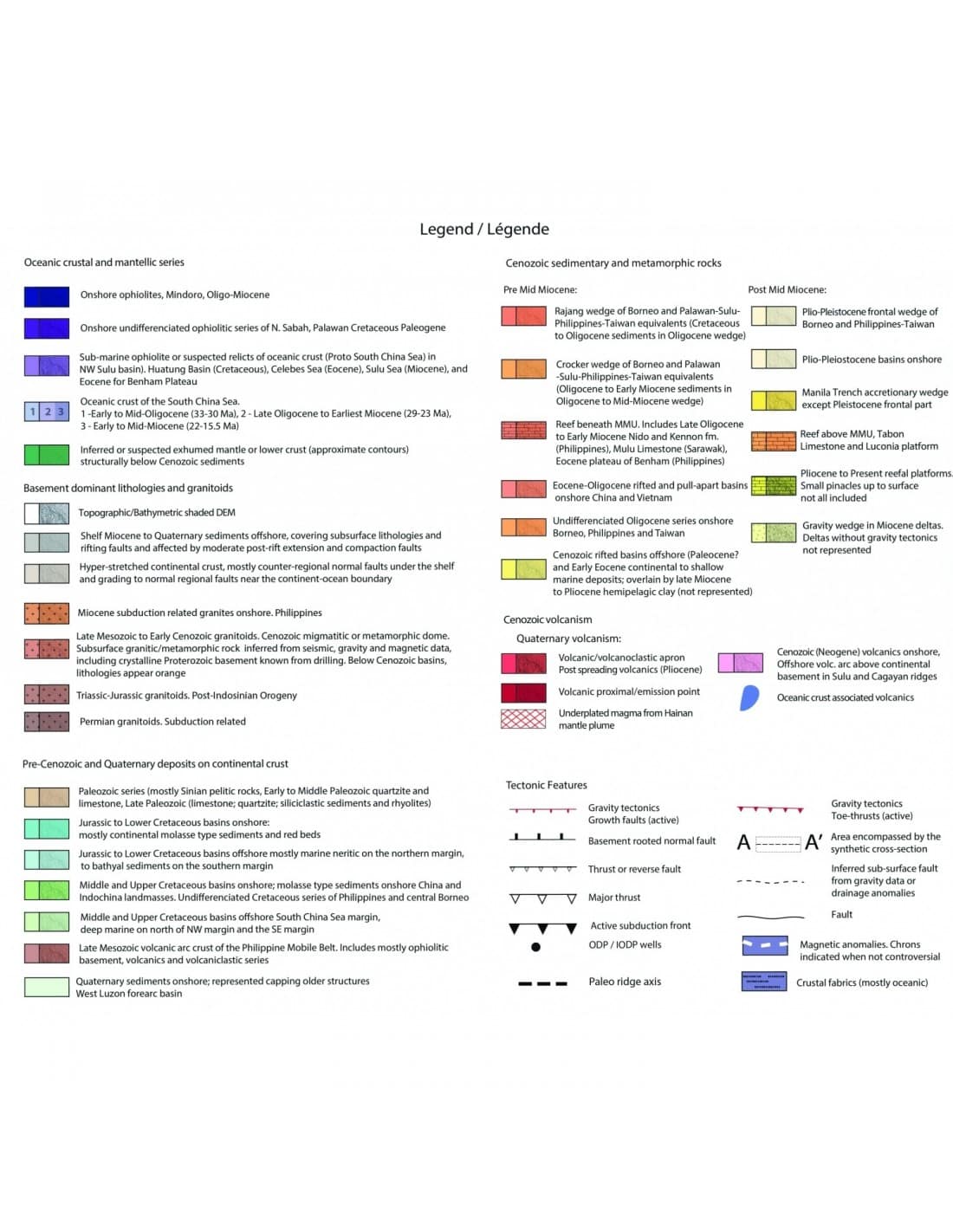
The legend can be downloaded by clicking here
Topo-bathymetric background: SRTM30+ v1.0, published in November 2004, see: http://topex.ucsd.edu/WWW_html/srtm30_plus
Altimetry from SRTM and GEBCO databases.
doi:10.14682/2017STRUCTUSCS
Structural map of the South China Sea-PDF

