
Tectonic map of South America
27,00 €
Tectonic map of South America
2nd edition 2016
Scale: 1:5,900,000
Polyconic projection
105 x 140 cm
Authors: Umberto G Cordani, University of São Paulo, Brazil, Victor A Ramos, University of Buenos Aires, Argentina, Lêda M Fraga, Inácio Delgado, Kaiser G de Souza, Francisco EM Gomes and Carlos Schobbenhaus of CPRM - Geological Survey of Brazil, and Marcelo Cegarra, SEGEMAR - Geological and Mining Survey of Argentina
Tectonic map of South America
Availability: In stock
Description
Tectonic map of South America
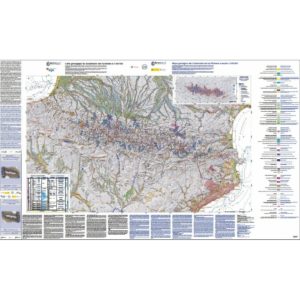
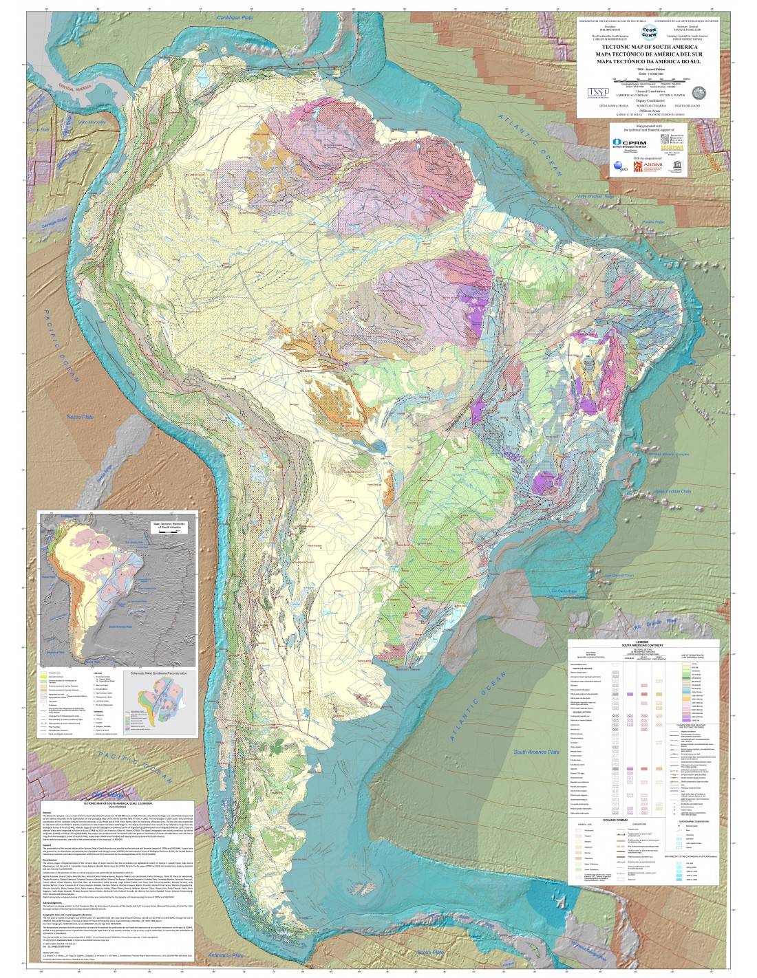
The project of a 2nd edition of the Tectonic Map of South America at 1:5 million scale was launched at the General Assembly of the Commission of the Geological Map of the World (CGMW) in 2002. Its compilation started in 2004, under the general coordination of Umberto Cordani (Brazil) and Victor Ramos (Argentina). Thanks to the technical and financial support of the Geological Surveys of Brazil (CPRM) and Argentina (SEGEMAR) it was possible to build the GIS database and to integrate a set of recent geochronological data. The final version of the map was subject to a scientific review, according to the CGPC procedure. For the printing of the map, the original scale of the map was reduced to 1/5.9 million.
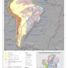
The South American tectonic plate comprises two sets, one oceanic and the other continental. The latter is characterised by two major domains: the Andean region and the South American platform. In order to facilitate the readability of the map, a unique legend has been developed for these two domains, whose elements are organised around three axes that have allowed their structuring and subsequent integration into the GIS database: (1) the age of the last tectonic event that affected a given region, represented by the colour of the polygon; (2) the nature of the tectonic environment, illustrated by superimposed figures; and (3) the age of formation of the rocks, indicated by the colour of the figures. A specific legend has been designed for marine areas that indicates, among other things, the age of the crust, the plate boundary and the fossil axes of ocean accretion.
Tectonic map of South America
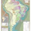
The map includes an inset showing the main geotectonic features of South America and the contrast between the Andean orogenic belt and the South American platform. Between these two major tectonic domains are the major sedimentary basins related to the Andean tectonics. Plate boundaries and other tectonic features of oceanic zones are also shown. The insert is completed by a reconstruction diagram of the western part of Gondwana that shows the structural correlations between the South American and African continents.
The authors wished to accompany this synthesis work with explanatory notes, written in English and available for download here. The themes covered are: the main tectonic features of South America, a detailed explanation of the elements that make up the legend and a summary of the tectonic evolution of the South American continent.
This second edition of the Tectonic Map of South America is the result of an important scientific cooperation between researchers and institutes from all the countries of South America; this map constitutes an essential element for the understanding and teaching of the main aspects of the tectonic evolution of the continent.
Tectonic map of South America
Informations complémentaires
| Weight | 0,195 kg |
|---|---|
| Dimensions | 140 × 105 cm |
| Packaging | Tube (e.g. rolled card), Envelope (e.g. folded card or booklet) |
| Length | |
| Width | |
| Weight | |
| Scale |