

Tectonic map of Antarctica - PDF
79,00 €
Tectonic map of Antarctica - PDF
Scale: 1:10,000,000
Published in July 2012
Size: 125 x 84 cm
Polar stereographic projection
CCGM-CGMW 2012
Authors: Garrik Grikurov and German Leychenkov (CCGM-VNIIOkeangeologia, St Petersburg)
Availability: In stock
Description
Tectonic map of Antarctica - PDF
Scanned version in high resolution .pdf format, sent by download link.
Note This card is subject to a licence agreement.
This map is also available in digital .pdf format in our catalogue.
Tectonic map of Antarctica - PDF
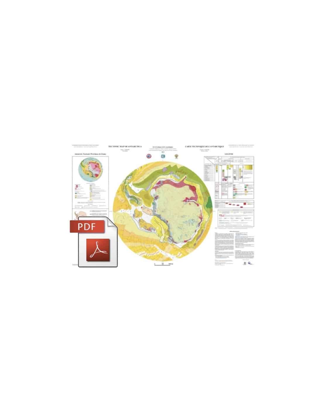
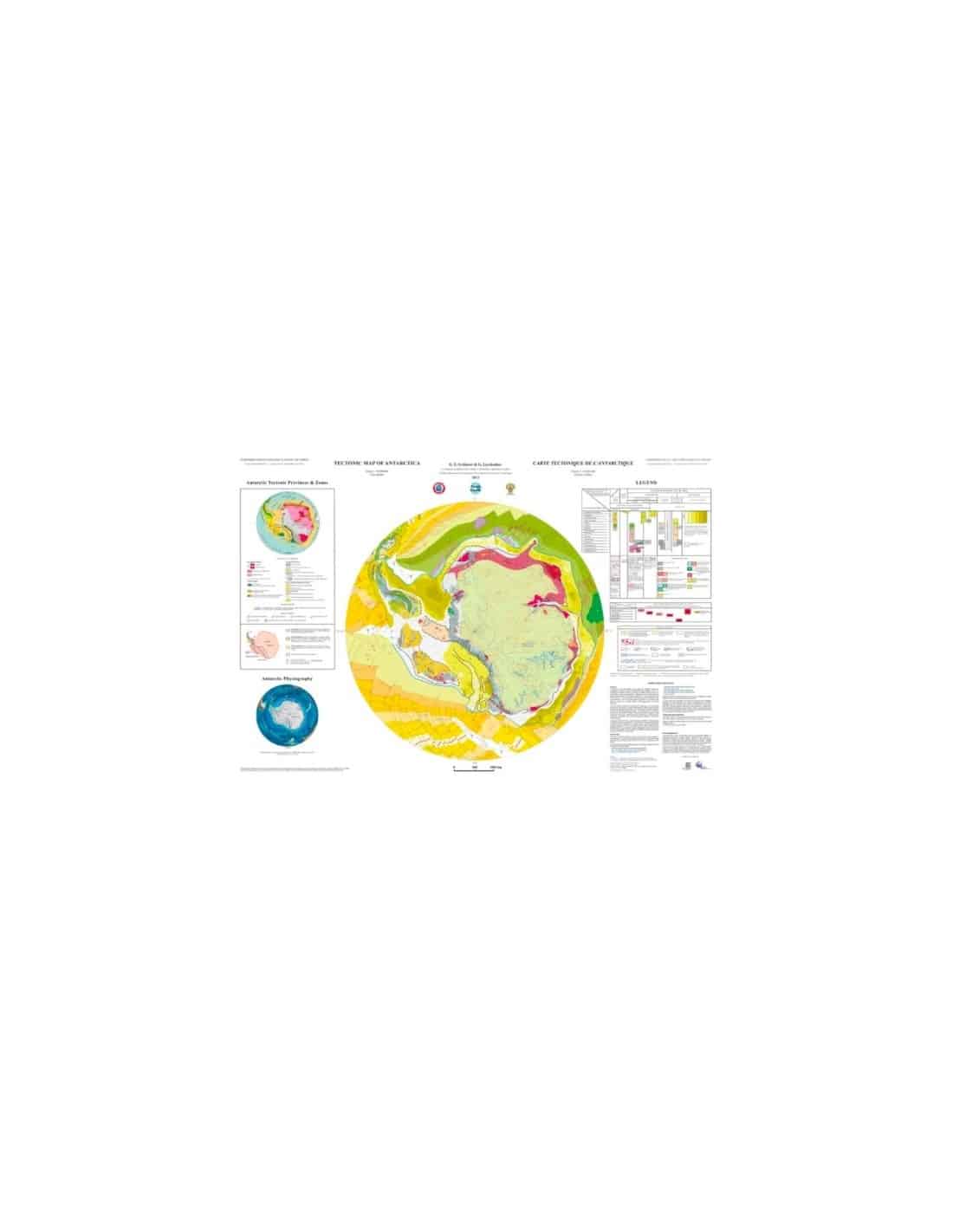
This map is the result of initiatives supported by the International Polar Year 2007-2009, following which the CCMG launched a programme in 2007 to prepare maps of the polar regions. The Antarctic domain, covering the region south of the 60°S parallel, was entrusted to the Gramberg Institute for Geological and Mining Research of the World's Oceans (VNIIOkeangeologia, St Petersburg, Russia). The first scale model of the new 1:10,000,000 Tectonic Map of Antarctica-PDF was completed in 2011 and, after critical review by specialists from the CGMW and other institutions, was printed in France for presentation at the 34th International Geological Congress (Brisbane, August 2012).
This first tectonic synthesis of Antarctica integrates historical knowledge of the geological structure of the Antarctic continent, the most recent results of geochemical and isotopic studies, and geophysical measurements obtained by oceanographic and airborne campaigns.
For the first time, continental structures and those of the circum-Antarctic domain are shown side by side, providing a completely new picture of the geodynamic history of this polar region as a whole. Following the principles of the other tectonic syntheses published by the CGMW, the legend has been designed so that the structural units and features mapped appear according to categories that distinguish their continental or oceanic nature, their age and the geodynamic framework of their formation.
The vast East Antarctic ice cap has been characterised in this map solely by the topography of its underlying bedrock. However, the interpretation of the structure of this region is presented in the small-scale box of the tectonic provinces of the Antarctic continent which, together with the box of the physiographic map, completes the data on the main map.
Tectonic map of Antarctica - PDF