

International Geological Map of Africa-PDF
42,00 €
International Geological Map of Africa-PDF
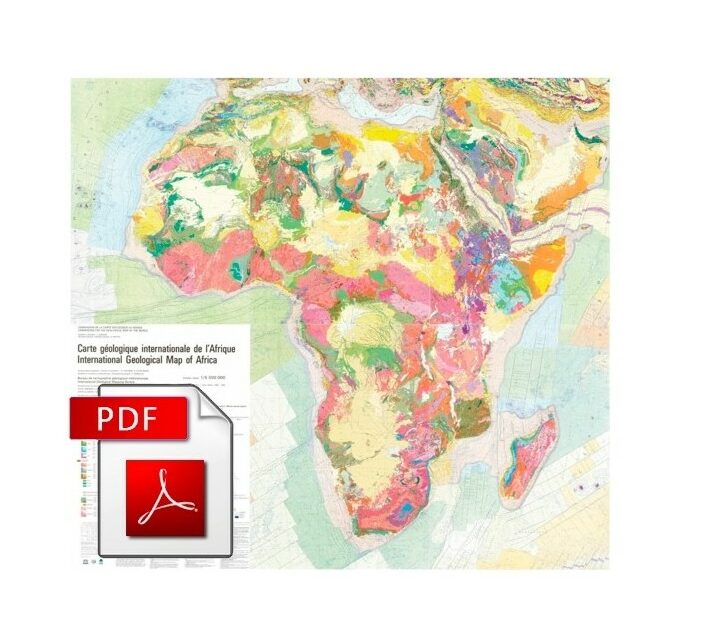
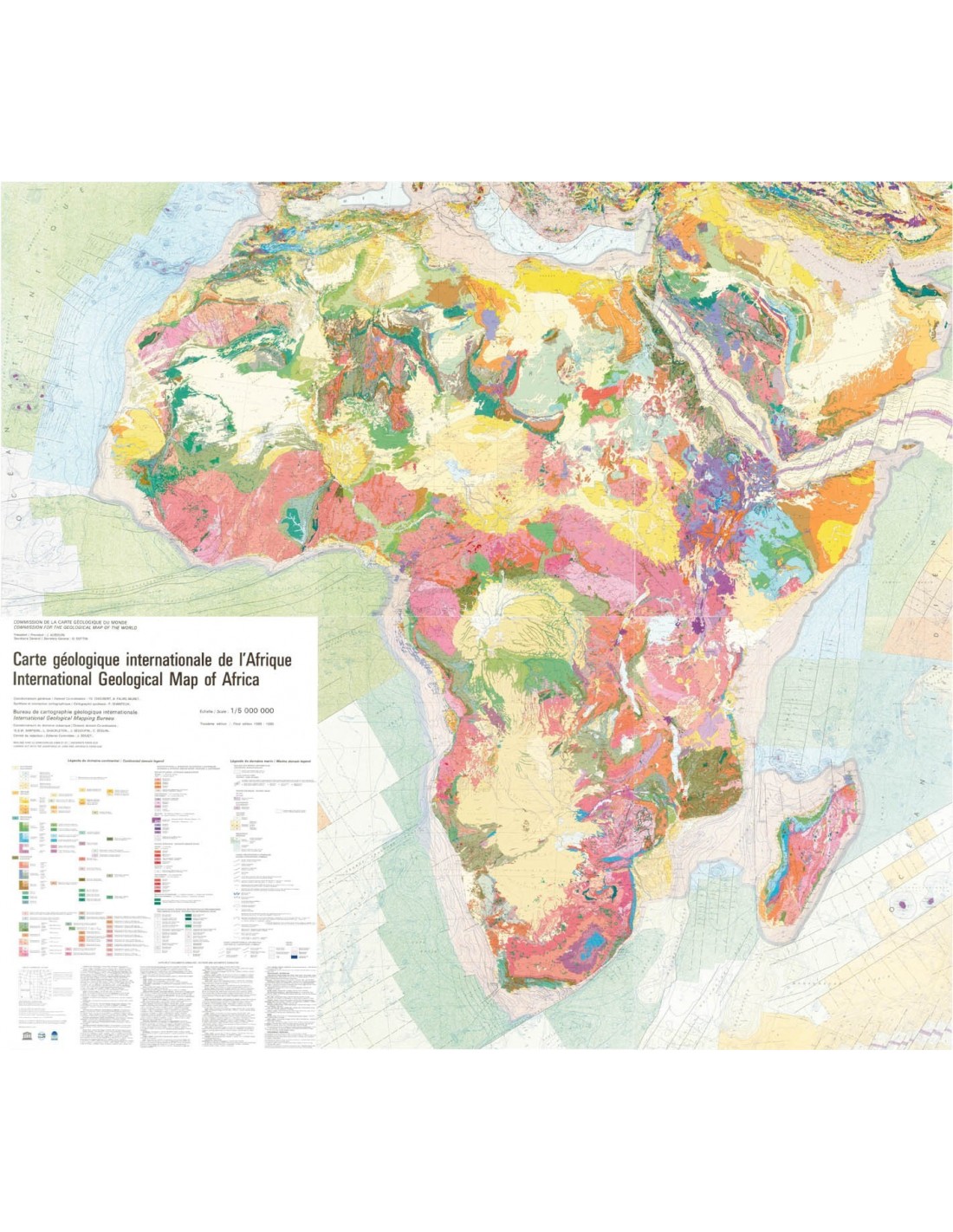
Set of 6 sheets (5 maps + 1 legend)
3rd edition at 1:5,000,000 (completed in 1990).
Bilingual: English/French
Size: 94 cm x 92 cm (Except main legend (no. 4): 94 cm x 72 cm)
Co-publication CCGM-UNESCO with the financial support of BRGM
Digital version in tiff, pdf and jpg formats, sent by download link.
Availability: In stock
Description
International Geological Map of Africa-PDF
Note: This map is subject to a licence agreement.
The compilation of this map was carried out between 1985 and 1990 by the Africa Sub-Commission of the CGMW under the general coordination of G. Choubert and A. Faure-Muret.
For this third edition a detailed legend has been designed, adapted to the scale of the map (1:5 000 000). The mapping of the surrounding oceanic regions shows bathymetry, magnetic anomalies, age of the oceanic crust, fracture zones, thickness of the sedimentary cover, epicentres of earthquakes and the location of DSDP boreholes.
Each of the five geological sheets has its own legend, which allows each sheet to be easily read independently of the rest of the set. The set of six sheets constitutes a document of scientific value and a first-rate educational tool for understanding the geology of the African continent.
This digital version consists of high resolution scans in pdf format.
International Geological Map of Africa-PDF
Informations complémentaires
| Length | |
|---|---|
| Width | |
| Weight | |
| Scale | |
| Digital format |


