A new look for our website! 🌱
As part of our commitment to the environment, we are in the process of switching to a more environmentally-friendly hosting provider. The site is currently being prepared for this transition.
Orders are temporarily suspended while the migration is finalised.
Thank you for your patience and support.
We look forward to seeing you soon with an even more ethical and efficient site!
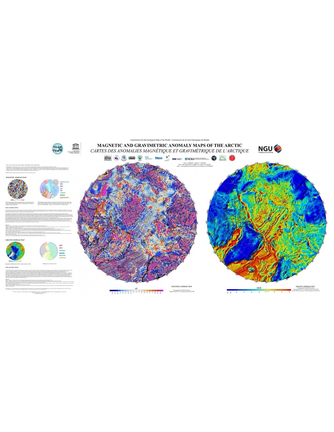
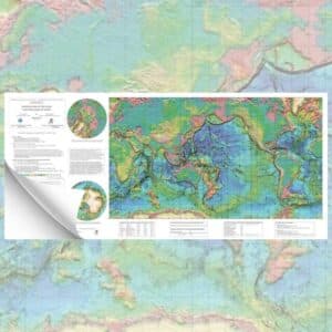
Map of magnetic and gravity anomalies in the Arctic
10,50 €
Map of magnetic and gravity anomalies in the Arctic
Scale: 1:15 000 000
Published in 2010
Polar stereographic projection
Dimensions: 126 x 58 cm
CCGM-CGMW 2010
Authors: Carmen GAINA, Stephanie C. WERNER, Mioara MANDEA and the CAMP-GM Group
Maps published with the financial support of the Norwegian Geological Survey (NGU)
Description
Map of magnetic and gravity anomalies in the Arctic
This new document is part of the new series of geophysical maps of the CCGM, and includes the magnetic anomaly map and the gravity anomaly map of the Arctic zone limited to parallel 60° N. This double map is the result of close international collaboration between research organisations from Russia, Canada, the USA, Finland, Sweden, Denmark, Norway, Germany and France.
This work has been published thanks to substantial financial support from the Norwegian Geological Survey (NGU).
The magnetic map shows very clearly the contrast between the continental zones, the Cenozoic oceanic accretion zones generated by the Gakkel accretionary rift and also shows the structural complexity of the Canadian basin. It is much more detailed than the polar sector - published at a smaller scale - of the World Magnetic Anomaly Map (WDMAM) published in 2007.
The gravity map corresponds to the Bouguer anomalies for continental areas, and to the Air Libre anomalies for marine areas.
The main interest of this document lies in the juxtaposition of these two maps, where we can see the complementary nature of the data provided by these two geophysical methods, and deduce a number of conclusions about the structure of the lithosphere in this particular sector of our globe.
Map of magnetic and gravity anomalies in the Arctic
Informations complémentaires
| Weight | 0,1 kg |
|---|---|
| Packaging | Tube (e.g. rolled card), Envelope (e.g. folded card or booklet) |
| Length | |
| Width | |
| Weight | |
| Scale |