


Tectonic Map of Northern, Central and Eastern Asia and Adjacent Regions-PDF
79,00 €
Tectonic Map of Northern, Central and Eastern Asia and Adjacent Regions-PDF
Chief Editors: O.V. Petrov, Yu. G. Leonov (Russia), Li Tingdong (China), O. Tomurtogoo (Mongolia)
Executive Editors: S.P. Shokalsky, I.I. Pospelov (Russia), Chen Bingwei, Ren Liudong (China), V. YA. Koshkin (Kazakhstan), Hwang Jae Hae (Republic of Korea)
Only available in PDF format. Set of 15 sheets, map size 284 x 310 cm, with instructions
Saint Petersburg, 2014
Tectonic Map of Northern Asia
Availability: In stock
Description
Tectonic Map of Northern, Central and Eastern Asia and Adjacent Regions-PDF
Note: This map is subject to a licence agreement.
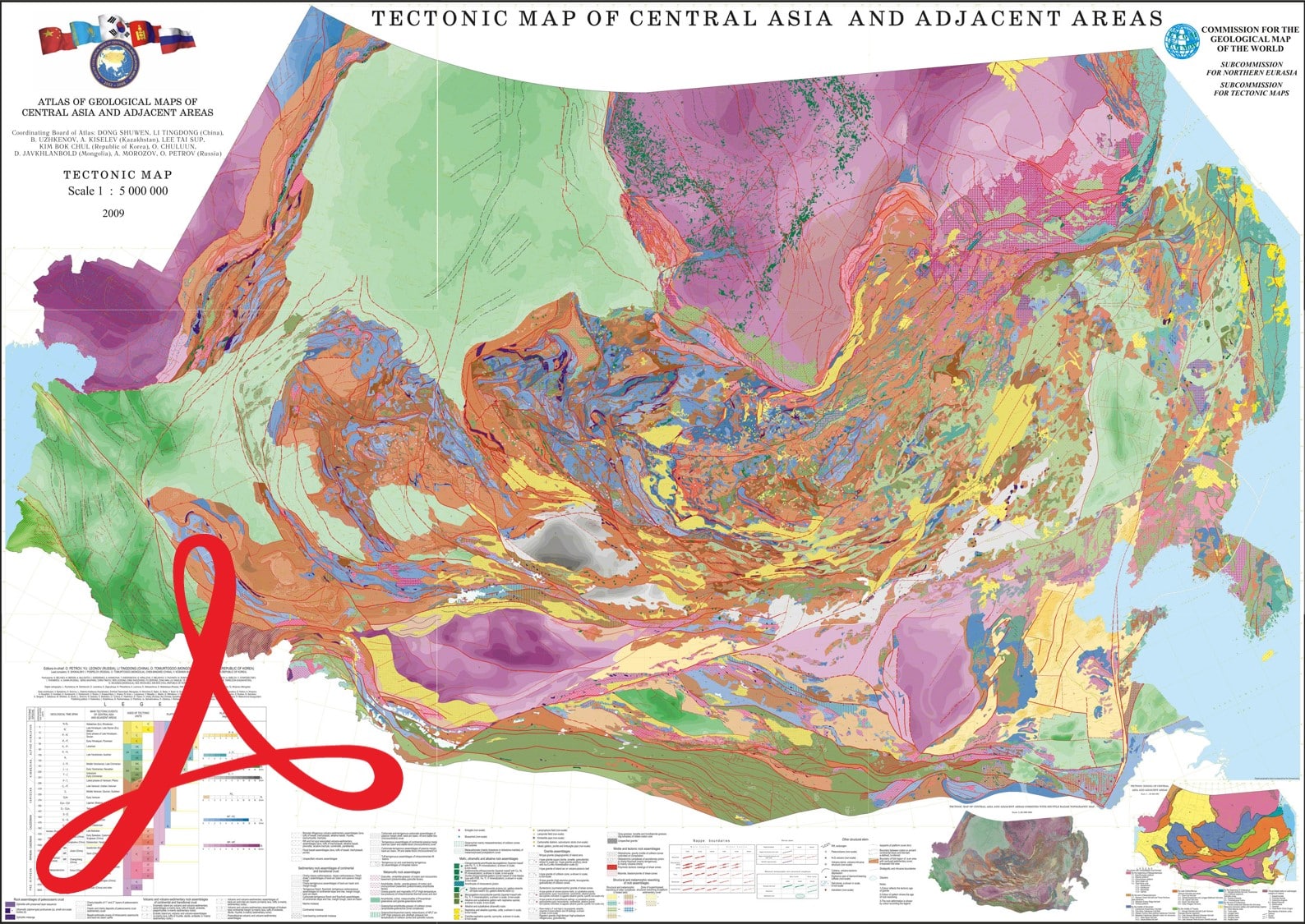
This brand new Tectonic Map of Northern, Central and Eastern Asia and Adjacent Regions-PDF at a scale of 1:2,500,000 was compiled by the A.P. Karpinsky Russian Geological Institute -VSEGEI, whose Director is the Vice-Chairman of the Sub-Commission for Northern Eurasia of the CGMW, and the Geological Institute of the Russian Academy of Sciences -GIN-RAS, which is part of the CGMW Sub-Commission for Tectonic Maps. This extensive mapping programme was an integral part of the international project "3D Geological Structures and Metallogeny of Northern, Central and Eastern Asia".
In this project, the Russian side (period 2007-2013) was represented by the Federal Agency for Mineral Resources of the Ministry of Natural Resources and Environment, VSEGEI, GIN-RAS, and the geological institutes of the Siberian branch of the Russian Academy of Sciences. The geological surveys of China, Mongolia, Kazakhstan and the Republic of Korea were associated as participants. The set of maps that make up the Atlas covers the Asian part of the Russian territory (including the Urals and the pre-Ural region), Kazakhstan, China, Mongolia, the Korean peninsula, and the Central Asian republics of Kyrgyzstan, Uzbekistan and Turkmenistan.
Tectonic Map of Northern Asia
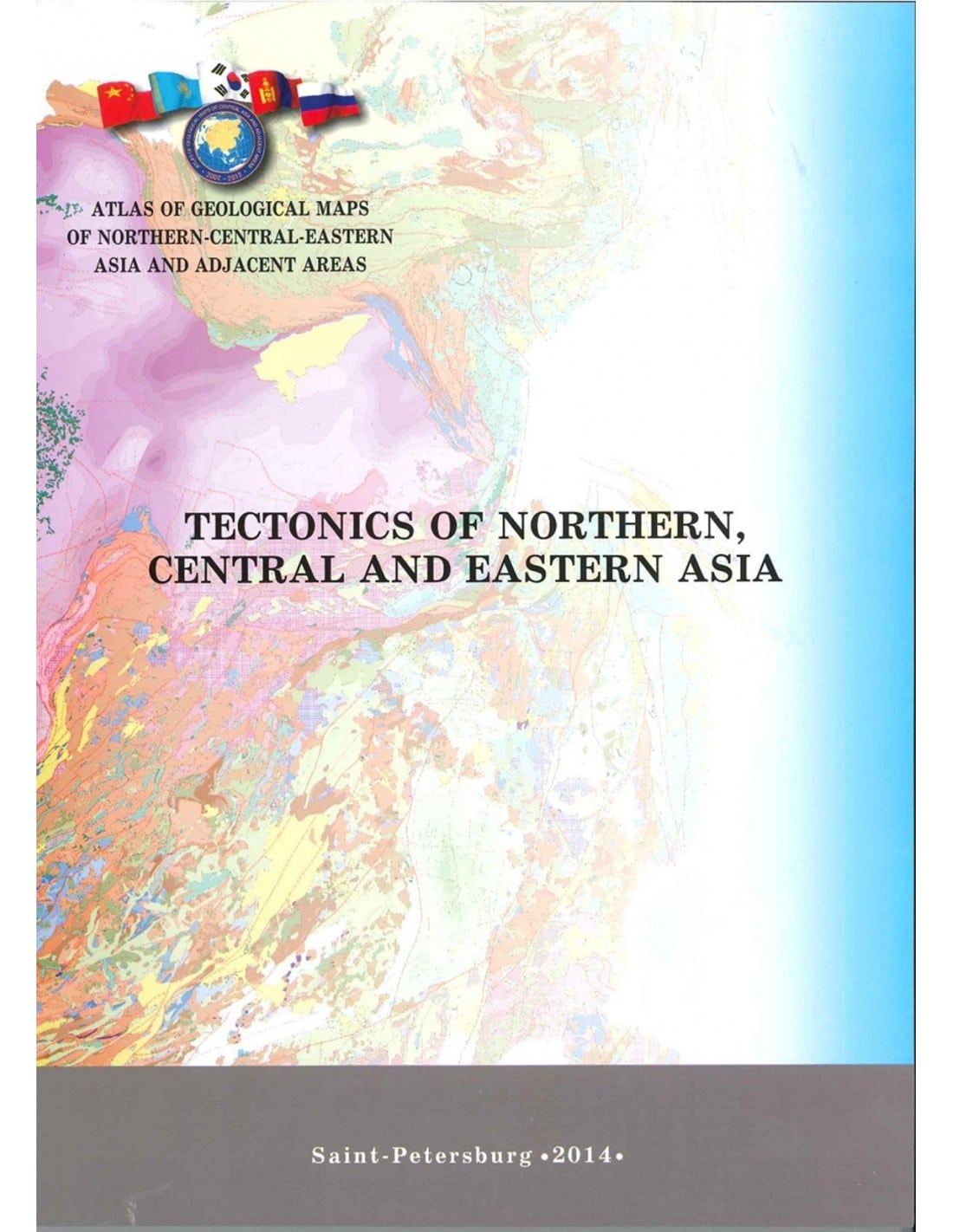
The Explanatory Notes to this map are the result of ten years of international collaboration between geologists from six countries: Russia, China, Mongolia, Kazakhstan, the Republic of Korea and the Democratic People's Republic of Korea. In addition to the above countries, the map also shows the tectonic structures of other Central Asian countries: Uzbekistan, Turkmenistan, Kyrgyzstan and Tajikistan.
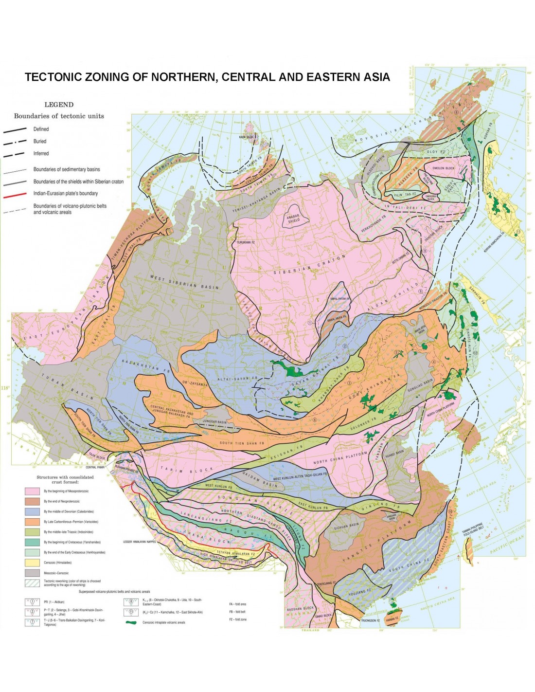
Structurally, the map covers three main structural domains of Eurasia, with the Central Asian mobile belt (Urals-Mongolia) being the central structure. On the map, it covers regions and structures such as the Urals, Kazakhstan, Tien Shan, Altai and Sayan massifs, the Transbaikal region, Mongolia, and the overlying young sedimentary platforms and basins ( Western Siberia, Turan, Dzungaria, Amur-Zeya, and part of Songliao).
The Central Asian mobile belt is surrounded by the largest and oldest cratons on Earth: the East European, Siberian, North China (Sino-Korean) and Tarim cratons. To the south, the Central-Asian mobile belt is bordered by the Tethyan domain, which includes structures in the Pamirs, Kunlun, Tibet–Himalayas, and Indochina. The Eastern Pacific domain incorporates the foldings of the following regions: Verkhoyansk-Kolyma, Chukotka-Koryak, Kamchatka, Sakhalin, the Sikhote-Alin Cordillera, as well as the folding of the southeastern coastal zone of southern China.
Tectonic Map of Northern Asia
The Explanatory Notes are of great interest because of the publication of new geochronological data, particularly from ancient cratonic basement metamorphic complexes and magmatic complexes. Particular attention has been paid to the age of ophiolites, a key element in understanding the most important stages in the evolution of the Earth's crust and the planet as a whole.
The writing and editing of the Notes was made possible by the teamwork of the compilers, the authors of the maps, and for the most part, the scientists and tectonists of the GIN-RAS institutes: Institute of Geology of Metalliferous Deposits, Petrography, Mineralogy and Geochemistry (IGEM-RAS); Institute of Geology (Ufimian Scientific Centre of the SAR); AN; Zavaritsky Institute of Geology and Geochemistry (Ural Branch of the SAR), and Geological Institute of the Siberian Branch of the SAR. Chapter 16 of these notes, "Neoproterozoic-Paleozoic Tectonic Evolution of the Ural-Mongolian Mobile Belt", is distinguished by its presentation in the form of successive palaeogeographic reconstructions.
The compilation of the Tectonic map of northern, central and eastern Asia and surrounding areas at a scale of 1:2,500,000The 3D Geological Structures and Metallogeny of Northern, Central and Eastern Asia project, as well as the other maps of the project, can be considered as the first large-scale international experiment in geological data integration, and a successful example of cooperation between specialists from different countries who, by pooling their knowledge and research capabilities, have contributed to the creation of numerous contacts in the geosciences community and innovative cartographic products.
Explanatory note reference: Tectonics of Northern, Central and Eastern Asia. Explanatory Note to the Tectonic map of Nortern-Central-Eastern Asia and Adjacent Areas at scale 1:2,500,00. SPb: VSEGEI Printing House, 2014, 192 pages ISBN 978-5-93761-215-1
Tectonic Map of Northern, Central and Eastern Asia and Adjacent Regions-PDF
Informations complémentaires
| Packaging | |
|---|---|
| Length | |
| Width | |
| Weight | |
| Scale |


