
Bathymetric Map of the Northeast Atlantic-PDF
32,00 €
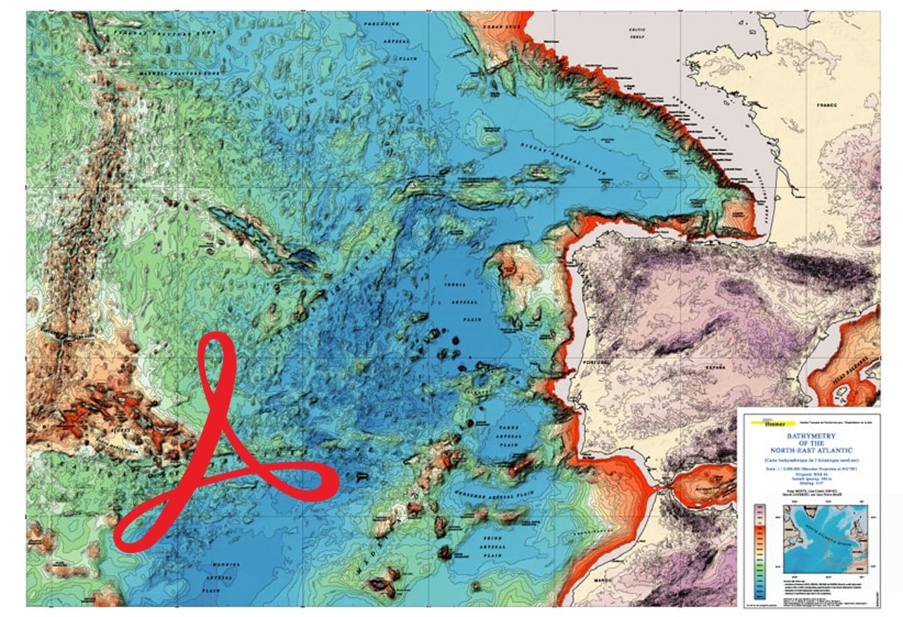
Bathymetric Map of the Northeast Atlantic-PDF
Scale: 1/2 400 000 (at 41°00′ N)
Projection: Mercator - Ellipsoid WGS 84
Contour spacing (sea and land): 200 m, shading: illumination from 315
Total surface: 119 x 84 cm (folded card)
IFREMER, 2004
Authors: S. Monti, J.-C. Sibuet, B. Loubrien, J.-P. Mazé
Availability: In stock
Description
Bathymetric Map of the Northeast Atlantic-PDF
Note: This map is subject to a licence agreement.
This map is the latest bathymetric compilation of the part of the North-East Atlantic between the Celtic Sea (Western approaches to the English Channel), the Strait of Gibraltar, Madeira, and the Mid-Atlantic Wrinkle associated with the Azores Hotspot. It includes, of course, the entire Bay of Biscay. This compilation work, completed in 2003, takes into account all conventional bathymetric surveys as well as those carried out with the multibeam echosounders of the IFREMER vessels ("Jean-Charcot", "Atalante", "Suroit").
The carefully chosen colour scheme, the 200 m spacing of the contour lines (isobaths and isohypses), the presence of shading, and the detailed underwater toponymy make this a very beautiful and legible cartographic document, in which the reliefs are particularly highlighted. This map is an indispensable working tool for all those interested in this region of the Atlantic, which recorded the opening of the Bay of Biscay in the Cretaceous, and which is bordered by the boundaries of the Eurasian plate with the African plate to the south and the North American plate to the west.
It should be noted that the back of the map shows the positions of the bathymetric "bands" surveyed by the multibeam echosounders of the IFREMER vessels mentioned above. This navigation can be shown transparently on the front of the map.
Bathymetric Map of the Northeast Atlantic-PDF
Informations complémentaires
| Packaging | |
|---|---|
| Length | |
| Width | |
| Weight | |
| Scale |


