


Geological map of the World at 1/35 M-GIS
1575,00 €
Geological map of the World at 1/35 M-GIS
Revised and restructured data from the geodatabase of the 2014 edition of the Geological Map of the World at 1:35,000,000
Digital and geomatic cartography by Carole Heyd & Damien Rambourg (BRGM)
Geodatabase
mxd files in English and French ArcGis10.0 and 10.5
Datasheet
Terms of Service
English/French Explanatory Notes
Edition 2017
© CCGM-CGMW Paris, 2014
Availability: In stock
Description
Geological map of the World at 1/35 M-GIS
Note This GIS is subject to a licence agreement, which can be downloaded from the "Download" tab on this page, and which must be signed and returned to ccgm@sfr.fr in order to receive the documents download link.
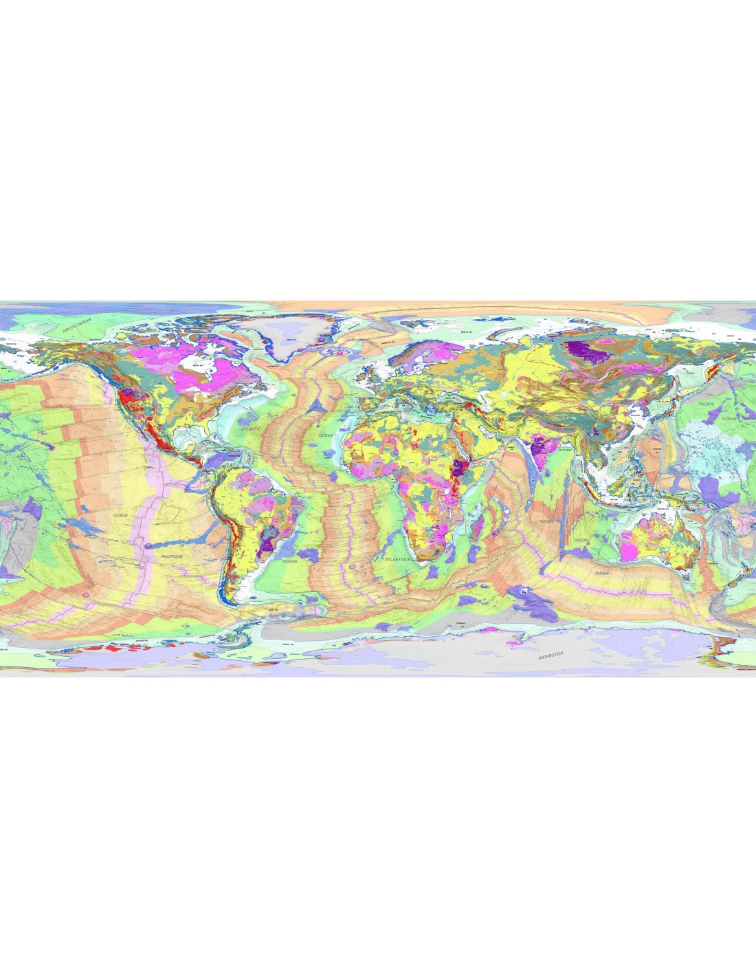
The 2017 edition of the Geographic Information System (GIS) database of the Geological Map of the World is the result of restructuring and improvement work carried out by Dr. Bruno VRIELYNCK (UPMC-CCGM) on the GIS project original of the 3rd edition of the map published in 2010 at a scale of 1:25,000,000.
The material behind the database comes from the digitization of the original manuscript of the author of the map, Dr. Philippe Bouysse (former Secretary General of the CCGM – 1990-2000). These georeferenced data had been processed with the ArcGIS software (version 9.0) in order to produce the graphic file of the printed map and the GIS project allowing access and extraction of graphic and scientific data from the map.
This initial constraint determined the creation of three geodatabases using two distinct projections: Mercator for the main map and stereographic for the North and South poles.
The evolution of GIS concepts and tools since 2010 as well as the way the geodatabase had been structured made the GIS 2010 project not compatible or difficult to render with more recent versions of ArcGIS.
After a detailed analysis of the old project, it proved necessary to homogenize, merge and reorganize the three geodatabases according to the principles of topology and set theory in order to generate a single database, under the same GCS_WGS_1984 coordinate system.
Following this redevelopment work, a style library was created to group all the symbols representing the graphic elements of the map (points, lines, polygons), as well as two .mxd projects respectively in English and French. A layer containing the digital terrain model (STRM) has been added to allow visualization of the relief.
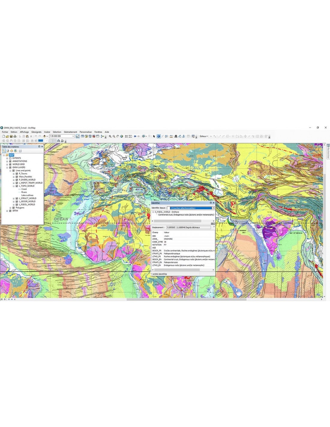
The information the database user has access to is as follows:
NOTATION: Geological notation
NAME: Element name
AGE: Numeric age of the item
DESCR_FR: Description in French
LITHO_FR: Lithologic attribute in French
STRAT_FR: Stratigraphic attribute in French
It is important to emphasize that to allow a logical organization of the map database, three main areas were considered: ONSHORE, OFFSHORE and OCEANIC. The coastline forms the boundary between the ONSHORE and the OFFSHORE. The base of the continental slope or island slope, or the limit of the continental margin in the case of Antarctica, is the boundary between the OFFSHORE and OCEANIC domains.
The OFFSHORE domain combines geographic and structural data. The other two domains contain exclusively geological and structural data. All data belongs to one or the other of these domains, never to both. The same fault may have an ONSHORE part and an OFFSHORE part, passing the limits defined above means that the line drawing the fault will include at least two arcs. The logic at work is not only of a topological order.
On the one hand, the research methods in the ONSHORE and OFFSHORE/OCEANIC domains are different and, on the other hand, stratigraphic criteria specific to each of these domains are applied for the creation of their legends. In the ONSHORE, the stratigraphic unit in the legend corresponds to the age of formation of the rock at the outcrop, while in the OCEANIC realm, the stratigraphic unit indicates the age of the oceanic crust below the sediments more recent deposited on the crust.
The database comes with a technical description that details the geodatabase structure, feature classes, class and field definitions, field properties, geodatabase domains, code definitions symbols, the properties of certain layers, the symbology references and style references, the symbols and the characteristics of the data frames in ArcMap. Precise indications are provided for the change of projection.
This 2017 version of the Geological Map of the World GIS database is the result of the work of highly specialized volunteer collaborators. By publishing this completely revised version, the Commission for the Geological Map of the World is once again honoring its commitment, made more than a century ago, to provide the international community of geoscientists and the general public with a small-scale synthesis that reflects the current state of geological knowledge of our planet.
Informations complémentaires
| Weight | |
|---|---|
| Scale | |
| Digital format |